
Magnitude |
:3.2 |
| Date & Time (UTC) | 2026-02-11 01:56:15.8 |
| Date & Time (Local) | 1404/11/22 05:26:15.8 |
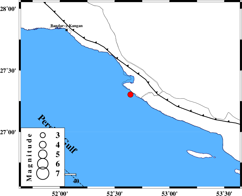
| Location | Lat:27.304 Lon: 52.643 |
| Region | Persian Gulf, 36 km South-West of Mehr |
Nearest Cities |
|
| 16 km West of Chah-e mobarak, Bushehr Province | |
| 19 km South of Bandar-e asaluyeh, Bushehr Province | |
| 35 km South West of Ardavan-e olia, Fars Province | |
| 36 km South West of Mehr, Fars Province | |
| 36 km South West of Khoozi, Fars Province | |
| Depth | 12 km |
| Agency | |
Faults within 150 km: |
|
| MFF3 (Length: 292 km) , Distance to epicenter: 19 km | |
| QIR_F (Length: 130 km) , Distance to epicenter: 126 km | |
| ZFF1 (Length: 165 km) , Distance to epicenter: 127 km | |
| Number of Phases | 5 |
| RMS | 0.3 |
| Number of Stations | 5 |
| Error in Latitude | >9.8 km |
| Error in Longitude | 9.8 km |
| Error in Depth | 690.7 km |
Download waveform in seisan format
to download seisan software Click here
to access information about IIEES stations Click here
Amplitude | ||||||||
| UID | Agency | Station | Component | Amplitude | Period | Arrival Time | Proccessing Time | Signal Clip |
| 201609 | IIEES SC | KRVR | Z | 0.02 | 1 | 2026-02-11 01:57:42 | 2026-02-18 06:55:00 | n |
| 201610 | IIEES SC | IRSR | Z | 0.005 | 1 | 2026-02-11 01:58:04 | 2026-02-18 06:55:00 | n |
Phase | ||||||||||||
| Agency | Station | Component | Phase Type | Phase Quality | First Motion | Observed Arrival Time | Time Residual | Loc. Flag | Input Weight | Distance | Azimuth | |
| IIEES SC | GENO | Z | EPn | E | 2026-02-11 01:57:07 | 0.1 | y | 0 | 349 | 88 | ||
| IIEES SC | ABH1 | Z | EPn | E | 2026-02-11 01:57:17 | 0.3 | y | 0 | 433 | 327 | ||
| IIEES SC | BRJ | Z | EPn | E | 2026-02-11 01:57:29 | -0.5 | y | 0 | 528 | 345 | ||
| IIEES SC | KRVR | Z | EPn | E | 2026-02-11 01:57:42 | 0.3 | y | 0 | 632 | 40 | ||
| IIEES SC | IRSR | Z | EPn | E | 2026-02-11 01:58:04 | -0.2 | y | 0 | 816 | 93 | ||