
Magnitude |
:3.6 |
| Date & Time (UTC) | 2026-02-13 11:53:42.2 |
| Date & Time (Local) | 1404/11/24 15:23:42.2 |
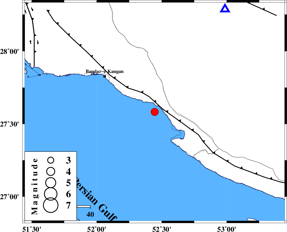
| Location | Lat:27.583 Lon: 52.446 |
| Region | Persian Gulf, 31 km South-East of Jam |
Nearest Cities |
|
| 14 km East of Bandar-e taheri, Bushehr Province | |
| 20 km North West of Bandar-e asaluyeh, Bushehr Province | |
| 24 km West of Gallehdar, Fars Province | |
| 28 km South West of Asir, Fars Province | |
| 31 km South East of Jam, Bushehr Province | |
| Depth | 12 km |
| Agency | |
Faults within 150 km: |
|
| MFF3 (Length: 292 km) , Distance to epicenter: 6 km | |
| BORAZJAN_F (Length: 168 km) , Distance to epicenter: 98 km | |
| QIR_F (Length: 130 km) , Distance to epicenter: 100 km | |
| Number of Phases | 5 |
| RMS | 0.6 |
| Number of Stations | 5 |
| Error in Latitude | >15 km |
| Error in Longitude | 15 km |
| Error in Depth | 999 km |
Download waveform in seisan format
to download seisan software Click here
to access information about IIEES stations Click here
Amplitude | ||||||||
| UID | Agency | Station | Component | Amplitude | Period | Arrival Time | Proccessing Time | Signal Clip |
| 201594 | IIEES SC | UOSS | Z | 0.09 | 1 | 2026-02-13 11:54:49 | 2026-02-18 07:29:00 | n |
| 201595 | IIEES SC | AMS1 | Z | 0.06 | 1 | 2026-02-13 11:55:01 | 2026-02-18 07:29:00 | n |
| 201596 | IIEES SC | IRSR | Z | 0.009 | 1 | 2026-02-13 11:55:33 | 2026-02-18 07:29:00 | n |
Phase | ||||||||||||
| Agency | Station | Component | Phase Type | Phase Quality | First Motion | Observed Arrival Time | Time Residual | Loc. Flag | Input Weight | Distance | Azimuth | |
| IIEES SC | GENO | Z | EPn | E | 2026-02-13 11:54:36 | 0.4 | y | 0 | 369 | 93 | ||
| IIEES SC | UOSS | Z | EPn | E | 2026-02-13 11:54:49 | 0.1 | y | 0 | 476 | 128 | ||
| IIEES SC | AMS1 | Z | EPn | E | 2026-02-13 11:55:01 | -0.7 | y | 0 | 577 | 329 | ||
| IIEES SC | IRSR | Z | EPn | E | 2026-02-13 11:55:33 | -0.5 | y | 0 | 836 | 95 | ||
| IIEES SC | QABG | Z | EPn | E | 2026-02-13 11:55:48 | 0.8 | y | 0 | 941 | 343 | ||