
Magnitude |
:3.3 |
| Date & Time (UTC) | 2026-02-08 13:38:02.6 |
| Date & Time (Local) | 1404/11/19 17:08:02.6 |
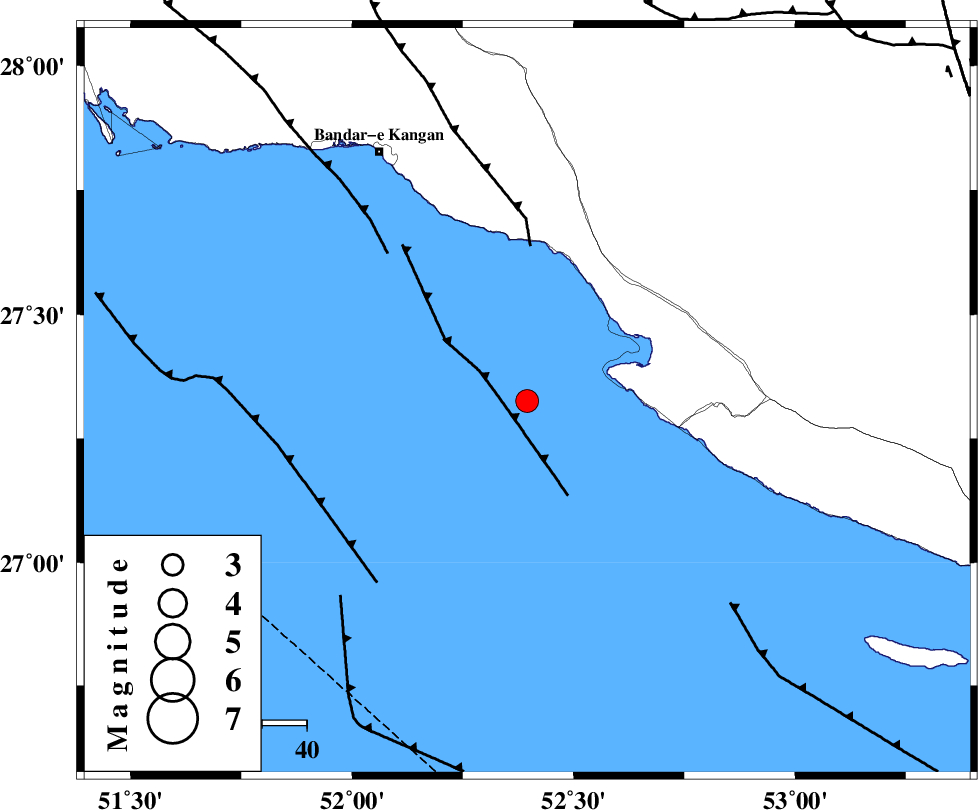
| Location | Lat:27.326 Lon: 52.395 |
| Region | Persian Gulf, 57 km South of Jam |
Nearest Cities |
|
| 26 km South West of Bandar-e asaluyeh, Bushehr Province | |
| 38 km South of Bandar-e taheri, Bushehr Province | |
| 39 km West of Chah-e mobarak, Bushehr Province | |
| 46 km South West of Gallehdar, Fars Province | |
| 50 km South West of Ardavan-e olia, Fars Province | |
| Depth | 12 km |
| Agency | |
Faults within 150 km: |
|
| MFF3 (Length: 292 km) , Distance to epicenter: 33 km | |
| BORAZJAN_F (Length: 168 km) , Distance to epicenter: 107 km | |
| MFF5 (Length: 74 km) , Distance to epicenter: 123 km | |
| Number of Phases | 5 |
| RMS | 0.3 |
| Number of Stations | 5 |
| Error in Latitude | >27.3 km |
| Error in Longitude | 52.4 km |
| Error in Depth | 12 km |
Download waveform in seisan format
to download seisan software Click here
to access information about IIEES stations Click here
Amplitude | ||||||||
| UID | Agency | Station | Component | Amplitude | Period | Arrival Time | Proccessing Time | Signal Clip |
| 201456 | IIEES SC | UOSS | Z | 0.03 | 1 | 2026-02-08 13:39:08 | 2026-02-09 07:49:00 | n |
| 201457 | IIEES SC | KRBR | Z | 0.04 | 1 | 2026-02-08 13:39:15 | 2026-02-09 07:49:00 | n |
| 201458 | IIEES SC | KRVR | Z | 0.02 | 1 | 2026-02-08 13:39:31 | 2026-02-09 07:49:00 | n |
Phase | ||||||||||||
| Agency | Station | Component | Phase Type | Phase Quality | First Motion | Observed Arrival Time | Time Residual | Loc. Flag | Input Weight | Distance | Azimuth | |
| IIEES SC | GHIR | Z | EPg | E | 2026-02-08 13:38:22 | -0.4 | y | 0 | 121 | 29 | ||
| IIEES SC | UOSS | Z | EPn | E | 2026-02-08 13:39:08 | 0 | y | 0 | 463 | 125 | ||
| IIEES SC | KRBR | Z | EPn | E | 2026-02-08 13:39:15 | 0 | y | 0 | 518 | 55 | ||
| IIEES SC | YZKH | Z | EPn | E | 2026-02-08 13:38:59 | -26 | n | 4 | 600 | 21 | ||
| IIEES SC | KRVR | Z | EPn | E | 2026-02-08 13:39:31 | 0.9 | y | 0 | 646 | 42 | ||