
Magnitude |
:3 |
| Date & Time (UTC) | 2026-02-01 02:45:26.8 |
| Date & Time (Local) | 1404/11/12 06:15:26.8 |
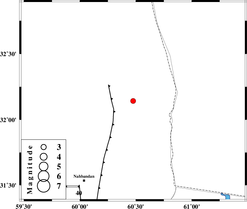
| Location | Lat:32.142 Lon: 60.476 |
| Region | Khorasan(south) Province, 79 km North-East of Nehbandan |
Nearest Cities |
|
| 24 km South of Dorj, Khorasan(south) Province | |
| 56 km North East of Shusef, Khorasan(south) Province | |
| 78 km South East of Tabas masina, Khorasan(south) Province | |
| 79 km South East of Salmabad, Khorasan(south) Province | |
| 79 km North East of Nehbandan, Khorasan(south) Province | |
| Depth | 12 km |
| Agency | |
Faults within 150 km: |
|
| E_NEH_F (Length: 148 km) , Distance to epicenter: 18 km | |
| W_NEH_F (Length: 158 km) , Distance to epicenter: 84 km | |
| SEFIDABAD_F (Length: 26 km) , Distance to epicenter: 86 km | |
| Number of Phases | 5 |
| RMS | 0.3 |
| Number of Stations | 5 |
| Error in Latitude | >32.1 km |
| Error in Longitude | 60.5 km |
| Error in Depth | 12 km |
Download waveform in seisan format
to download seisan software Click here
to access information about IIEES stations Click here
Amplitude | ||||||||
| UID | Agency | Station | Component | Amplitude | Period | Arrival Time | Proccessing Time | Signal Clip |
| 201285 | IIEES SC | SHRT | Z | 0.3 | 1 | 2026-02-01 02:45:54 | 2026-02-01 07:02:00 | n |
| 201286 | IIEES SC | ZHSF | Z | 0.08 | 1 | 2026-02-01 02:46:09 | 2026-02-01 07:02:00 | n |
| 201287 | IIEES SC | KRBR | Z | 0.1 | 1 | 2026-02-01 02:46:28 | 2026-02-01 07:02:00 | n |
| 201288 | IIEES SC | SRVN | Z | 0.01 | 1 | 2026-02-01 02:46:44 | 2026-02-01 07:02:00 | n |
Phase | ||||||||||||
| Agency | Station | Component | Phase Type | Phase Quality | First Motion | Observed Arrival Time | Time Residual | Loc. Flag | Input Weight | Distance | Azimuth | |
| IIEES SC | SHRT | Z | EPg | E | 2026-02-01 02:45:54 | 0 | y | 0 | 168 | 354 | ||
| IIEES SC | ZHSF | Z | EPn | E | 2026-02-01 02:46:09 | -0.7 | y | 0 | 282 | 174 | ||
| IIEES SC | KRBR | Z | EPn | E | 2026-02-01 02:46:28 | 0.1 | y | 0 | 428 | 236 | ||
| IIEES SC | YZKH | Z | EPn | E | 2026-02-01 02:46:29 | -14.9 | n | 4 | 555 | 273 | ||
| IIEES SC | SRVN | Z | EPn | E | 2026-02-01 02:46:44 | 0.2 | y | 0 | 557 | 161 | ||