
Magnitude |
:4.9 |
| Date & Time (UTC) | 2026-01-23 11:18:05.1 |
| Date & Time (Local) | 1404/11/3 14:48:05.1 |
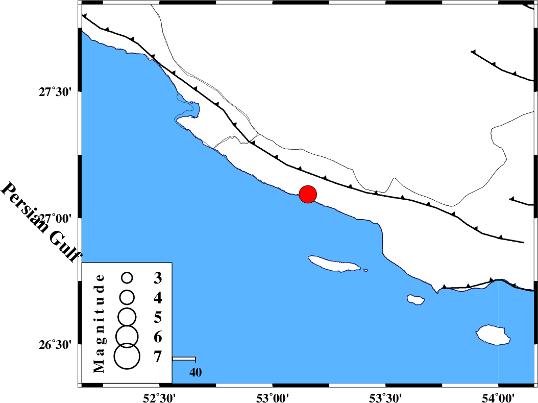
| Location | Lat:27.093 Lon: 53.156 |
| Region | Hormozgan Province, 27 km South of Lamerd |
Nearest Cities |
|
| 27 km South of Lamerd, Fars Province | |
| 43 km South East of Khoozi, Fars Province | |
| 47 km South East of Chah-e mobarak, Bushehr Province | |
| 47 km South West of Ashkenan, Fars Province | |
| 51 km South West of Beyram, Fars Province | |
| Depth | 12 km |
| Agency | |
Faults within 150 km: |
|
| MFF3 (Length: 292 km) , Distance to epicenter: 14 km | |
| ZFF1 (Length: 165 km) , Distance to epicenter: 72 km | |
| MFF1 (Length: 180 km) , Distance to epicenter: 88 km | |
| Number of Phases | 9 |
| RMS | 0.2 |
| Number of Stations | 9 |
| Error in Latitude | >4.9 km |
| Error in Longitude | 4.9 km |
| Error in Depth | 304.7 km |
Download waveform in seisan format
to download seisan software Click here
to access information about IIEES stations Click here
Amplitude | ||||||||
| UID | Agency | Station | Component | Amplitude | Period | Arrival Time | Proccessing Time | Signal Clip |
| 201172 | IIEES SC | GENO | Z | 10 | 1 | 2026-01-23 11:18:50 | 2026-01-25 05:46:00 | n |
| 201173 | IIEES SC | KRVR | Z | 0.5 | 1 | 2026-01-23 11:19:30 | 2026-01-25 05:46:00 | n |
| 201174 | IIEES SC | IRSR | Z | 0.2 | 1 | 2026-01-23 11:19:48 | 2026-01-25 05:46:00 | n |
| 201175 | IIEES SC | KOO | Z | 1 | 1 | 2026-01-23 11:19:55 | 2026-01-25 05:46:00 | n |
Phase | ||||||||||||
| Agency | Station | Component | Phase Type | Phase Quality | First Motion | Observed Arrival Time | Time Residual | Loc. Flag | Input Weight | Distance | Azimuth | |
| IIEES SC | GHIR | Z | EPg | E | 2026-01-23 11:18:31 | 4.2 | n | 4 | 133 | 353 | ||
| IIEES SC | GENO | Z | EPn | E | 2026-01-23 11:18:50 | -0.2 | y | 0 | 301 | 83 | ||
| IIEES SC | GENO | Z | ES | E | 2026-01-23 11:19:21 | -2.1 | n | 4 | 301 | 83 | ||
| IIEES SC | KRVR | Z | EPn | E | 2026-01-23 11:19:30 | 0 | y | 0 | 620 | 35 | ||
| IIEES SC | AMS1 | Z | EPn | E | 2026-01-23 11:19:31 | -3.1 | n | 4 | 660 | 326 | ||
| IIEES SC | IRSR | Z | EPn | E | 2026-01-23 11:19:48 | 0.4 | y | 0 | 765 | 91 | ||
| IIEES SC | SFB | Z | EPn | E | 2026-01-23 11:19:53 | 0 | y | 0 | 810 | 354 | ||
| IIEES SC | KOO | Z | EPn | E | 2026-01-23 11:19:55 | 0.2 | y | 0 | 818 | 44 | ||
| IIEES SC | SRVN | Z | EPn | E | 2026-01-23 11:20:06 | -0.2 | y | 0 | 916 | 88 | ||