
Magnitude |
:3.5 |
| Date & Time (UTC) | 2026-01-18 20:24:06.7 |
| Date & Time (Local) | 1404/10/28 23:54:06.7 |
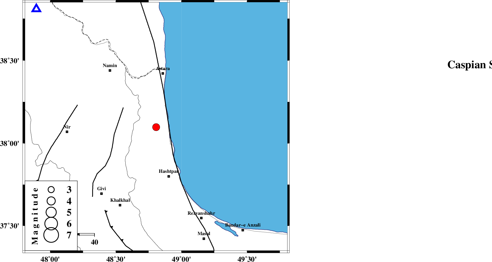
| Location | Lat:38.098 Lon: 48.807 |
| Region | Gilan Province, 36 km South of Astara |
Nearest Cities |
|
| 10 km of Hariq, Gilan Province | |
| 17 km North West of Lisar, Gilan Province | |
| 24 km South of Londovil, Gilan Province | |
| 25 km East of Hir, Ardebil Province | |
| 29 km North West of Chelonasr, Gilan Province | |
| Depth | 16 km |
| Agency | |
Faults within 150 km: |
|
| TALESH_F (Length: 258 km) , Distance to epicenter: 22 km | |
| SANGAVAR_F (Length: 61 km) , Distance to epicenter: 25 km | |
| BOZQUSH (Length: 70 km) , Distance to epicenter: 54 km | |
| Number of Phases | 9 |
| RMS | 0.4 |
| Number of Stations | 9 |
| Error in Latitude | >4 km |
| Error in Longitude | 4 km |
| Error in Depth | 9.6 km |
Download waveform in seisan format
to download seisan software Click here
to access information about IIEES stations Click here
Amplitude | ||||||||
| UID | Agency | Station | Component | Amplitude | Period | Arrival Time | Proccessing Time | Signal Clip |
| 201157 | IIEES SC | SRSL | Z | 0.1 | 1 | 2026-01-18 20:24:59 | 2026-01-19 07:58:00 | n |
| 201158 | IIEES SC | ASAO | Z | 0.1 | 1 | 2026-01-18 20:25:04 | 2026-01-19 07:58:00 | n |
| 201159 | IIEES SC | SFB | Z | 0.03 | 1 | 2026-01-18 20:25:17 | 2026-01-19 07:58:00 | n |
| 201160 | IIEES SC | ABGH | Z | 0.06 | 1 | 2026-01-18 20:25:22 | 2026-01-19 07:58:00 | n |
| 201161 | IIEES SC | BJRD | Z | 0.01 | 1 | 2026-01-18 20:25:48 | 2026-01-19 07:58:00 | n |
Phase | ||||||||||||
| Agency | Station | Component | Phase Type | Phase Quality | First Motion | Observed Arrival Time | Time Residual | Loc. Flag | Input Weight | Distance | Azimuth | |
| IIEES SC | GIDE | Z | EPg | E | 2026-01-18 20:24:32 | 0.2 | y | 0 | 158 | 145 | ||
| IIEES SC | SRSL | Z | EPn | E | 2026-01-18 20:24:59 | -0.2 | y | 0 | 366 | 235 | ||
| IIEES SC | ASAO | Z | EPn | E | 2026-01-18 20:25:04 | -0.3 | y | 0 | 409 | 164 | ||
| IIEES SC | HNVD | Z | EPn | E | 2026-01-18 20:25:07 | 0.4 | y | 0 | 423 | 187 | ||
| IIEES SC | GHVR | Z | EPn | E | 2026-01-18 20:25:11 | 0.5 | y | 0 | 457 | 151 | ||
| IIEES SC | DOB | Z | EPn | E | 2026-01-18 20:25:14 | -0.2 | y | 0 | 482 | 187 | ||
| IIEES SC | SFB | Z | EPn | E | 2026-01-18 20:25:17 | -0.9 | y | 0 | 518 | 143 | ||
| IIEES SC | ABGH | Z | EPn | E | 2026-01-18 20:25:22 | 0.1 | y | 0 | 552 | 106 | ||
| IIEES SC | BJRD | Z | EPn | E | 2026-01-18 20:25:48 | 0.4 | y | 0 | 758 | 93 | ||