
Magnitude |
:3.1 |
| Date & Time (UTC) | 2026-01-12 01:54:22.8 |
| Date & Time (Local) | 1404/10/22 05:24:22.8 |
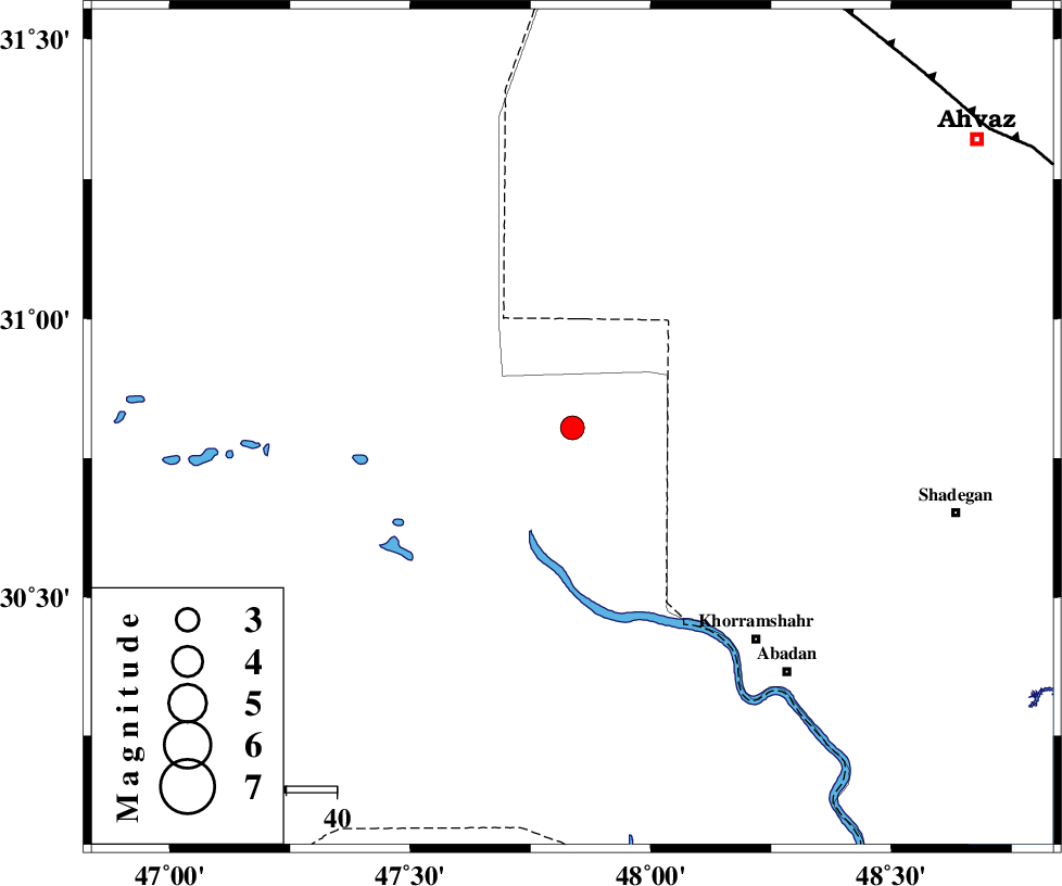
| Location | Lat:30.804 Lon: 47.837 |
| Region | Iraq, 32 km North of Al Basrah |
Nearest Cities |
|
| 32 km North of Al Basrah, Iraq Province | |
| 47 km North West of Polno, Khoozestan Province | |
| 56 km North West of Khorramshahr, Khoozestan Province | |
| 57 km North West of Darkhovin, Khoozestan Province | |
| 65 km North West of Abadan, Khoozestan Province | |
| Depth | 12 km |
| Agency | |
Faults within 150 km: |
|
| AHVAZ_F (Length: 99 km) , Distance to epicenter: 99 km | |
| AGHAJARI_F (Length: 88 km) , Distance to epicenter: 140 km | |
| Number of Phases | 6 |
| RMS | 0.5 |
| Number of Stations | 6 |
| Error in Latitude | >26.2 km |
| Error in Longitude | 26.2 km |
| Error in Depth | 39.8 km |
Download waveform in seisan format
to download seisan software Click here
to access information about IIEES stations Click here
Amplitude | ||||||||
| UID | Agency | Station | Component | Amplitude | Period | Arrival Time | Proccessing Time | Signal Clip |
| 201012 | IIEES SC | AMS1 | Z | 0.4 | 1 | 2026-01-12 01:54:55 | 2026-01-12 07:58:00 | n |
| 201013 | IIEES SC | GHVR | Z | 0.03 | 1 | 2026-01-12 01:55:36 | 2026-01-12 07:58:00 | n |
| 201014 | IIEES SC | NASN | Z | 0.02 | 1 | 2026-01-12 01:55:35 | 2026-01-12 07:58:00 | n |
Phase | ||||||||||||
| Agency | Station | Component | Phase Type | Phase Quality | First Motion | Observed Arrival Time | Time Residual | Loc. Flag | Input Weight | Distance | Azimuth | |
| IIEES SC | AMS1 | Z | EPn | E | 2026-01-12 01:54:55 | -0.2 | y | 0 | 201 | 47 | ||
| IIEES SC | AMS1 | Z | ES | E | 2026-01-12 01:55:17 | -1.5 | n | 4 | 201 | 47 | ||
| IIEES SC | HAGD | Z | EPn | E | 2026-01-12 01:55:27 | -0.5 | y | 0 | 462 | 15 | ||
| IIEES SC | GHVR | Z | EPn | E | 2026-01-12 01:55:36 | 1 | y | 0 | 518 | 38 | ||
| IIEES SC | NASN | Z | EPn | E | 2026-01-12 01:55:35 | -0.4 | y | 0 | 520 | 65 | ||
| IIEES SC | SRSL | Z | EPn | E | 2026-01-12 01:55:50 | 0.4 | y | 0 | 640 | 340 | ||