
Magnitude |
:3.1 |
| Date & Time (UTC) | 2025-11-21 03:28:02.1 |
| Date & Time (Local) | 1404/8/30 06:58:02.1 |
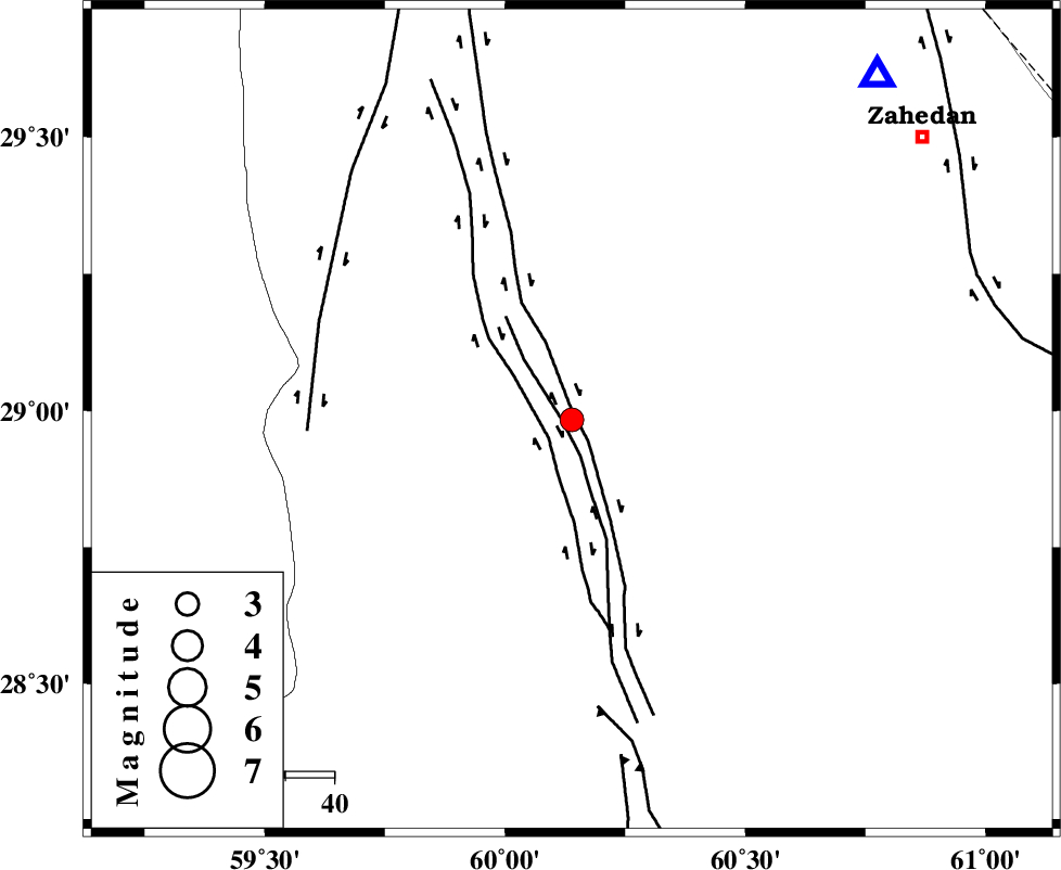
| Location | Lat:28.983 Lon: 60.139 |
| Region | Sistan va Baloochestan Province, 91 km South-West of Zahedan |
Nearest Cities |
|
| 41 km North West of Mohamadabad, Sistan va Baloochestan Province | |
| 48 km South of Hesaruyeh, Sistan va Baloochestan Province | |
| 55 km North West of Nazil, Sistan va Baloochestan Province | |
| 61 km South West of Mohamadabad, Sistan va Baloochestan Province | |
| 74 km North West of Dehpayd, Sistan va Baloochestan Province | |
| Depth | 12 km |
| Agency | |
Faults within 150 km: |
|
| NOSRATABAD_F_Z3 (Length: 150 km) , Distance to epicenter: 2 km | |
| NOSRATABAD_F_Z2 (Length: 81 km) , Distance to epicenter: 2 km | |
| NOSRATABAD_F_Z1 (Length: 109 km) , Distance to epicenter: 6 km | |
| Number of Phases | 6 |
| RMS | 0.8 |
| Number of Stations | 6 |
| Error in Latitude | >3.5 km |
| Error in Longitude | 3.5 km |
| Error in Depth | 18.1 km |
Download waveform in seisan format
to download seisan software Click here
to access information about IIEES stations Click here
Amplitude | ||||||||
| UID | Agency | Station | Component | Amplitude | Period | Arrival Time | Proccessing Time | Signal Clip |
| 200247 | IIEES SC | KRBR | Z | 0.1 | 1 | 2025-11-21 03:28:53 | 2025-11-22 06:29:00 | n |
| 200248 | IIEES SC | TABS | Z | 0.02 | 1 | 2025-11-21 03:29:24 | 2025-11-22 06:29:00 | n |
| 200249 | IIEES SC | UOSS | Z | 0.009 | 1 | 2025-11-21 03:29:22 | 2025-11-22 06:29:00 | n |
Phase | ||||||||||||
| Agency | Station | Component | Phase Type | Phase Quality | First Motion | Observed Arrival Time | Time Residual | Loc. Flag | Input Weight | Distance | Azimuth | |
| IIEES SC | ZHSF | Z | EPg | E | 2025-11-21 03:28:17 | -0.6 | y | 0 | 93 | 41 | ||
| IIEES SC | IRSR | Z | EPn | E | 2025-11-21 03:28:40 | 0.9 | y | 0 | 234 | 162 | ||
| IIEES SC | BSRN | Z | EPn | E | 2025-11-21 03:28:47 | -5.9 | n | 4 | 345 | 344 | ||
| IIEES SC | KRBR | Z | EPn | E | 2025-11-21 03:28:53 | 0.1 | y | 0 | 346 | 289 | ||
| IIEES SC | TABS | Z | EPn | E | 2025-11-21 03:29:24 | 1 | y | 0 | 592 | 331 | ||
| IIEES SC | UOSS | Z | EPn | E | 2025-11-21 03:29:22 | -0.9 | y | 0 | 594 | 221 | ||