
Magnitude |
:2.7 |
| Date & Time (UTC) | 2025-11-17 10:54:38.5 |
| Date & Time (Local) | 1404/8/26 14:24:38.5 |
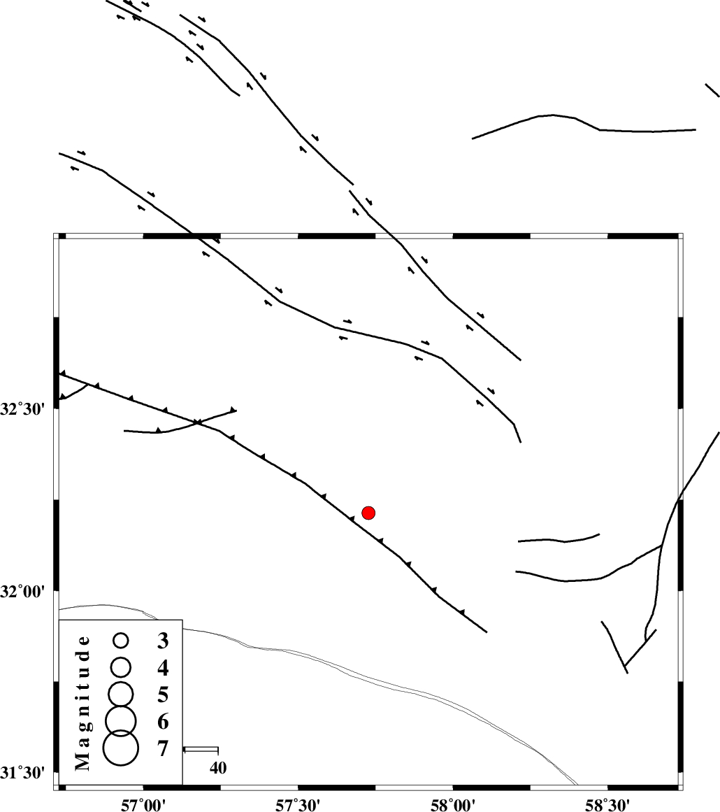
| Location | Lat:32.214 Lon: 57.727 |
| Region | Yazd Province, 136 km North-East of Ravar |
Nearest Cities |
|
| 27 km North East of Hoz-e qorban, Yazd Province | |
| 95 km South of Arababad, Yazd Province | |
| 105 km South West of Hur, Khorasan(south) Province | |
| 109 km South West of Hamand, Khorasan(south) Province | |
| 117 km South West of Bisheh bala, Khorasan(south) Province | |
| Depth | 12 km |
| Agency | |
Faults within 150 km: |
|
| NAYBAND_F (Length: 258 km) , Distance to epicenter: 22 km | |
| ESFARDIAR_F (Length: 94 km) , Distance to epicenter: 79 km | |
| LAKARKUH_F (Length: 138 km) , Distance to epicenter: 87 km | |
| Number of Phases | 6 |
| RMS | 0.5 |
| Number of Stations | 6 |
| Error in Latitude | >4.2 km |
| Error in Longitude | 4.2 km |
| Error in Depth | 21.4 km |
Download waveform in seisan format
to download seisan software Click here
to access information about IIEES stations Click here
Amplitude | ||||||||
| UID | Agency | Station | Component | Amplitude | Period | Arrival Time | Proccessing Time | Signal Clip |
| 200179 | IIEES SC | BSRN | Z | 0.2 | 1 | 2025-11-17 10:55:00 | 2025-11-18 05:15:00 | n |
| 200180 | IIEES SC | TABS | Z | 0.2 | 1 | 2025-11-17 10:55:05 | 2025-11-18 05:15:00 | n |
| 200181 | IIEES SC | KRBR | Z | 0.07 | 1 | 2025-11-17 10:55:19 | 2025-11-18 05:15:00 | n |
| 200182 | IIEES SC | YZKH | Z | 0.1 | 1 | 2025-11-17 10:55:23 | 2025-11-18 05:15:00 | n |
Phase | ||||||||||||
| Agency | Station | Component | Phase Type | Phase Quality | First Motion | Observed Arrival Time | Time Residual | Loc. Flag | Input Weight | Distance | Azimuth | |
| IIEES SC | BSRN | Z | EPg | E | 2025-11-17 10:55:00 | -0.1 | y | 0 | 135 | 102 | ||
| IIEES SC | TABS | Z | EPg | E | 2025-11-17 10:55:05 | -0.9 | y | 0 | 169 | 340 | ||
| IIEES SC | TABS | Z | ESg | E | 2025-11-17 10:55:22 | -4.3 | n | 4 | 169 | 340 | ||
| IIEES SC | KRBR | Z | EPn | E | 2025-11-17 10:55:19 | -0.3 | y | 0 | 264 | 200 | ||
| IIEES SC | SHRT | Z | EPn | E | 2025-11-17 10:55:22 | 0.8 | y | 0 | 288 | 56 | ||
| IIEES SC | YZKH | Z | EPn | E | 2025-11-17 10:55:23 | 0.5 | y | 0 | 296 | 274 | ||