
Magnitude |
:3.5 |
| Date & Time (UTC) | 2025-11-09 22:50:25.7 |
| Date & Time (Local) | 1404/8/19 02:20:25.7 |
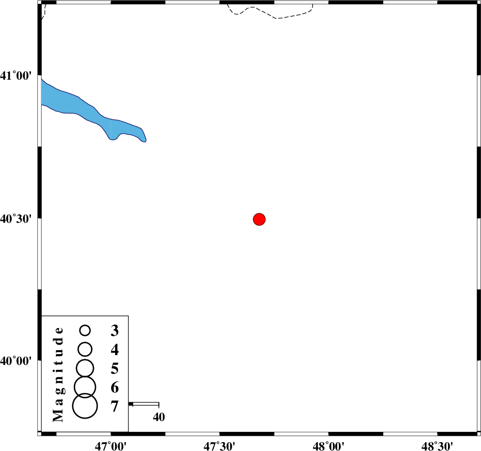
| Location | Lat:40.496 Lon: 47.681 |
| Region | Azerbaijan, 96 km North-West of Pars Abad |
Nearest Cities |
|
| 96 km North West of Pars Abad, Ardebil Province | |
| 97 km North West of Kushlu, Ardebil Province | |
| 100 km North West of Tazeh kand-e gadim, Ardebil Province | |
| 116 km North West of Jaefarabad, Ardebil Province | |
| 120 km North East of Aslanduz, Ardebil Province | |
| Depth | 12 km |
| Agency | |
Faults within 150 km: |
|
| TALESH_F (Length: 258 km) , Distance to epicenter: 125 km | |
| DASHT_E_MOGHAN__ (Length: 104 km) , Distance to epicenter: 133 km | |
| Number of Phases | 9 |
| RMS | 0.3 |
| Number of Stations | 9 |
| Error in Latitude | >4.9 km |
| Error in Longitude | 4.9 km |
| Error in Depth | 16.8 km |
Download waveform in seisan format
to download seisan software Click here
to access information about IIEES stations Click here
Amplitude | ||||||||
| UID | Agency | Station | Component | Amplitude | Period | Arrival Time | Proccessing Time | Signal Clip |
| 200030 | IIEES SC | GNI | Z | 0.2 | 1 | 2025-11-09 22:51:05 | 2025-11-10 09:52:00 | n |
| 200031 | IIEES SC | GLO | Z | 0.05 | 1 | 2025-11-09 22:51:59 | 2025-11-10 09:52:00 | n |
| 200032 | IIEES SC | MRVT | Z | 0.01 | 1 | 2025-11-09 22:52:12 | 2025-11-10 09:52:00 | n |
Phase | ||||||||||||
| Agency | Station | Component | Phase Type | Phase Quality | First Motion | Observed Arrival Time | Time Residual | Loc. Flag | Input Weight | Distance | Azimuth | |
| IIEES SC | GRMI | Z | EPg | E | 2025-11-09 22:50:57 | 0.7 | y | 0 | 188 | 174 | ||
| IIEES SC | GRMI | Z | ESg | E | 2025-11-09 22:51:19 | 0.7 | n | 4 | 188 | 174 | ||
| IIEES SC | GNI | Z | EPn | E | 2025-11-09 22:51:05 | 0 | y | 0 | 253 | 261 | ||
| IIEES SC | GIDE | Z | EPn | E | 2025-11-09 22:51:27 | -0.7 | y | 0 | 438 | 155 | ||
| IIEES SC | SRSL | Z | EPn | E | 2025-11-09 22:51:52 | 15.3 | n | 4 | 514 | 202 | ||
| IIEES SC | KIV | Z | EPn | E | 2025-11-09 22:52:15 | 31.6 | n | 4 | 564 | 313 | ||
| IIEES SC | GLO | Z | EPn | E | 2025-11-09 22:51:59 | -0.3 | y | 0 | 696 | 130 | ||
| IIEES SC | ABGH | Z | EPn | E | 2025-11-09 22:52:07 | 0.5 | y | 0 | 747 | 124 | ||
| IIEES SC | MRVT | Z | EPn | E | 2025-11-09 22:52:12 | 0 | y | 0 | 793 | 113 | ||