
Magnitude |
:3.2 |
| Date & Time (UTC) | 2025-10-17 09:09:17.2 |
| Date & Time (Local) | 1404/7/25 12:39:17.2 |
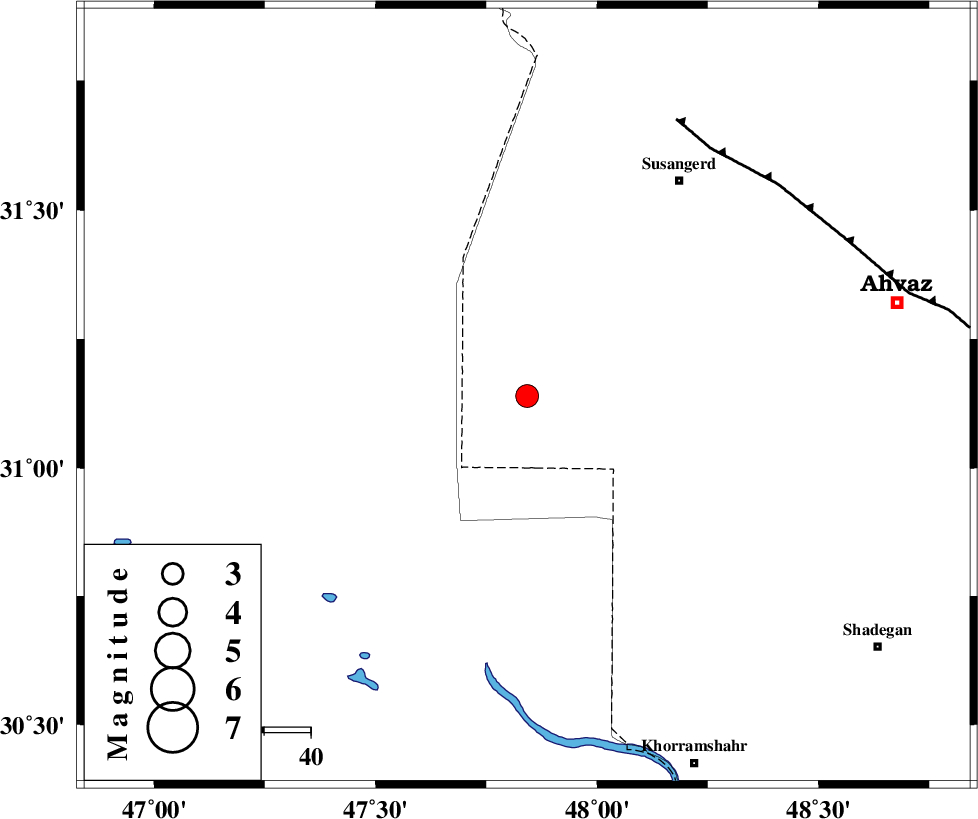
| Location | Lat:31.14 Lon: 47.842 |
| Region | Khoozestan Province, 69 km North of Al Basrah |
Nearest Cities |
|
| 42 km South West of Hoveizeh, Khoozestan Province | |
| 57 km South West of Susangerd, Khoozestan Province | |
| 59 km South West of Jalaliyeh, Khoozestan Province | |
| 66 km South West of Bostan, Khoozestan Province | |
| 67 km West of Bahr, Khoozestan Province | |
| Depth | 10 km |
| Agency | |
Faults within 150 km: |
|
| AHVAZ_F (Length: 99 km) , Distance to epicenter: 66 km | |
| AGHAJARI_F (Length: 88 km) , Distance to epicenter: 133 km | |
| Number of Phases | 7 |
| RMS | 0.3 |
| Number of Stations | 7 |
| Error in Latitude | >9 km |
| Error in Longitude | 9 km |
| Error in Depth | 38.1 km |
Download waveform in seisan format
to download seisan software Click here
to access information about IIEES stations Click here
Amplitude | ||||||||
| UID | Agency | Station | Component | Amplitude | Period | Arrival Time | Proccessing Time | Signal Clip |
| 199659 | IIEES SC | BSR2 | Z | 0.9 | 1 | 2025-10-17 09:09:33 | 2025-10-18 04:57:00 | n |
| 199660 | IIEES SC | NASN | Z | 0.06 | 1 | 2025-10-17 09:10:28 | 2025-10-18 04:57:00 | n |
| 199661 | IIEES SC | CHTH | Z | 0.02 | 1 | 2025-10-17 09:10:41 | 2025-10-18 04:57:00 | n |
| 199662 | IIEES SC | MEH | Z | 0.01 | 1 | 2025-10-17 09:10:45 | 2025-10-18 04:57:00 | n |
Phase | ||||||||||||
| Agency | Station | Component | Phase Type | Phase Quality | First Motion | Observed Arrival Time | Time Residual | Loc. Flag | Input Weight | Distance | Azimuth | |
| IIEES SC | BSR2 | Z | EPg | E | 2025-10-17 09:09:33 | -0.1 | y | 0 | 96 | 193 | ||
| IIEES SC | NASN | Z | EPn | E | 2025-10-17 09:10:28 | 0.1 | y | 0 | 504 | 69 | ||
| IIEES SC | GHIR | Z | EPn | E | 2025-10-17 09:10:38 | 0.2 | y | 0 | 590 | 122 | ||
| IIEES SC | SRSL | Z | EPn | E | 2025-10-17 09:10:54 | 13.8 | n | 4 | 605 | 338 | ||
| IIEES SC | CHTH | Z | EPn | E | 2025-10-17 09:10:41 | 0.3 | y | 0 | 610 | 30 | ||
| IIEES SC | DAMV | Z | EPn | E | 2025-10-17 09:10:36 | -7.3 | n | 4 | 629 | 38 | ||
| IIEES SC | MEH | Z | EPn | E | 2025-10-17 09:10:45 | -0.6 | y | 0 | 646 | 88 | ||