
Magnitude |
:2.8 |
| Date & Time (UTC) | 2025-10-02 20:42:26.9 |
| Date & Time (Local) | 1404/7/11 00:12:26.9 |
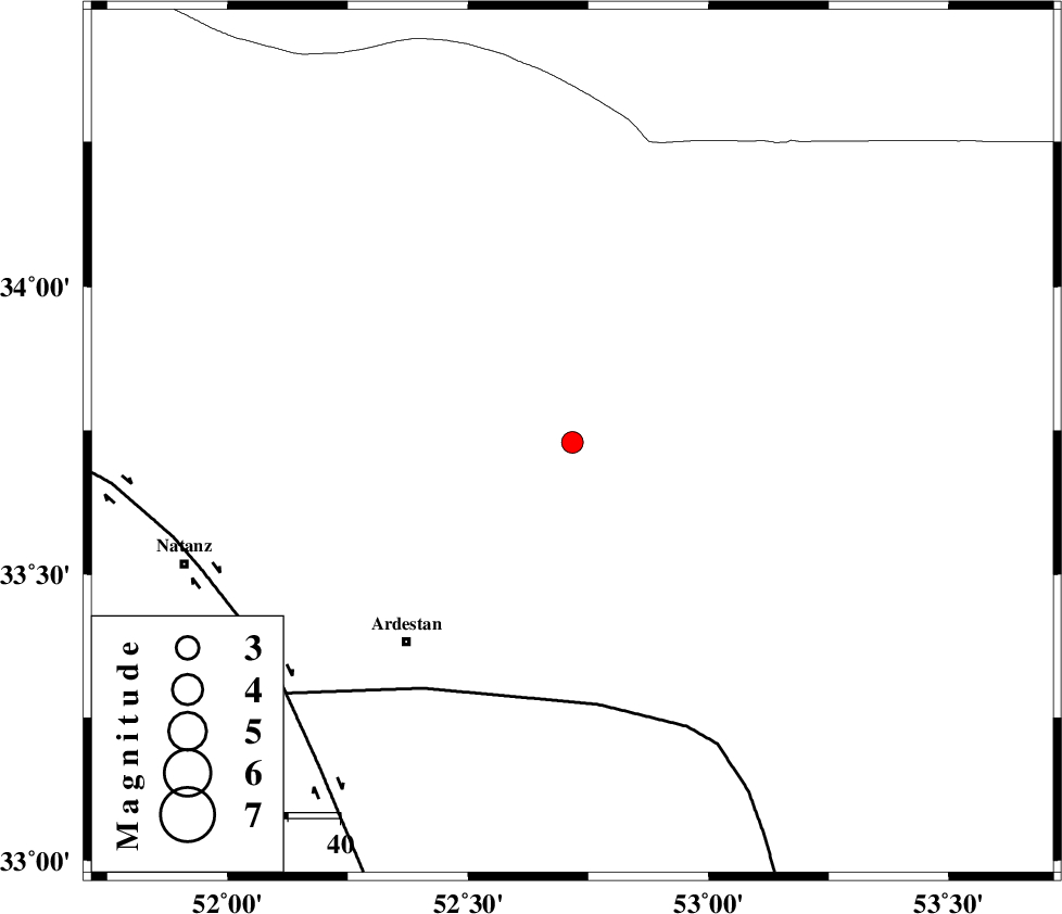
| Location | Lat:33.729 Lon: 52.717 |
| Region | Esfahan Province, 50 km North-East of Ardestan |
Nearest Cities |
|
| 30 km North of Jahanabad, Esfahan Province | |
| 38 km North East of Zavareh, Esfahan Province | |
| 38 km North East of Telkabad, Esfahan Province | |
| 46 km North of Shahrab, Esfahan Province | |
| 50 km North East of Ardestan, Esfahan Province | |
| Depth | 10 km |
| Agency | |
Faults within 150 km: |
|
| CHAH_ZANGUL_F (Length: 123 km) , Distance to epicenter: 51 km | |
| ZEFREH_F (Length: 124 km) , Distance to epicenter: 72 km | |
| SIAHKUH_F (Length: 154 km) , Distance to epicenter: 101 km | |
| Number of Phases | 7 |
| RMS | 0.6 |
| Number of Stations | 7 |
| Error in Latitude | >4.7 km |
| Error in Longitude | 4.7 km |
| Error in Depth | 24.7 km |
Download waveform in seisan format
to download seisan software Click here
to access information about IIEES stations Click here
Amplitude | ||||||||
| UID | Agency | Station | Component | Amplitude | Period | Arrival Time | Proccessing Time | Signal Clip |
| 199454 | IIEES SC | NASN | Z | 0.4 | 1 | 2025-10-02 20:42:57 | 2025-10-04 07:41:00 | n |
| 199455 | IIEES SC | NASN | Z | 0.4 | 1 | 2025-10-02 20:42:43 | 2025-10-04 07:41:00 | n |
| 199456 | IIEES SC | ASAO | Z | 0.1 | 1 | 2025-10-02 20:43:08 | 2025-10-04 07:41:00 | n |
Phase | ||||||||||||
| Agency | Station | Component | Phase Type | Phase Quality | First Motion | Observed Arrival Time | Time Residual | Loc. Flag | Input Weight | Distance | Azimuth | |
| IIEES SC | NASN | Z | EPg | E | 2025-10-02 20:42:43 | -0.9 | y | 0 | 103 | 175 | ||
| IIEES SC | NASN | Z | ESg | E | 2025-10-02 20:42:57 | 0 | y | 0 | 103 | 175 | ||
| IIEES SC | DAMV | Z | EPn | E | 2025-10-02 20:42:46 | -16.5 | n | 4 | 222 | 342 | ||
| IIEES SC | YZKH | Z | EPn | E | 2025-10-02 20:42:42 | -20.9 | n | 4 | 230 | 130 | ||
| IIEES SC | ASAO | Z | EPn | E | 2025-10-02 20:43:08 | 0.2 | y | 0 | 264 | 290 | ||
| IIEES SC | MEH | Z | EPn | E | 2025-10-02 20:43:15 | 0.9 | y | 0 | 315 | 146 | ||
| IIEES SC | GLO | Z | EPn | E | 2025-10-02 20:43:14 | -0.6 | y | 0 | 324 | 18 | ||