
Magnitude |
:3 |
| Date & Time (UTC) | 2025-07-27 22:22:29.3 |
| Date & Time (Local) | 1404/5/6 01:52:29.3 |
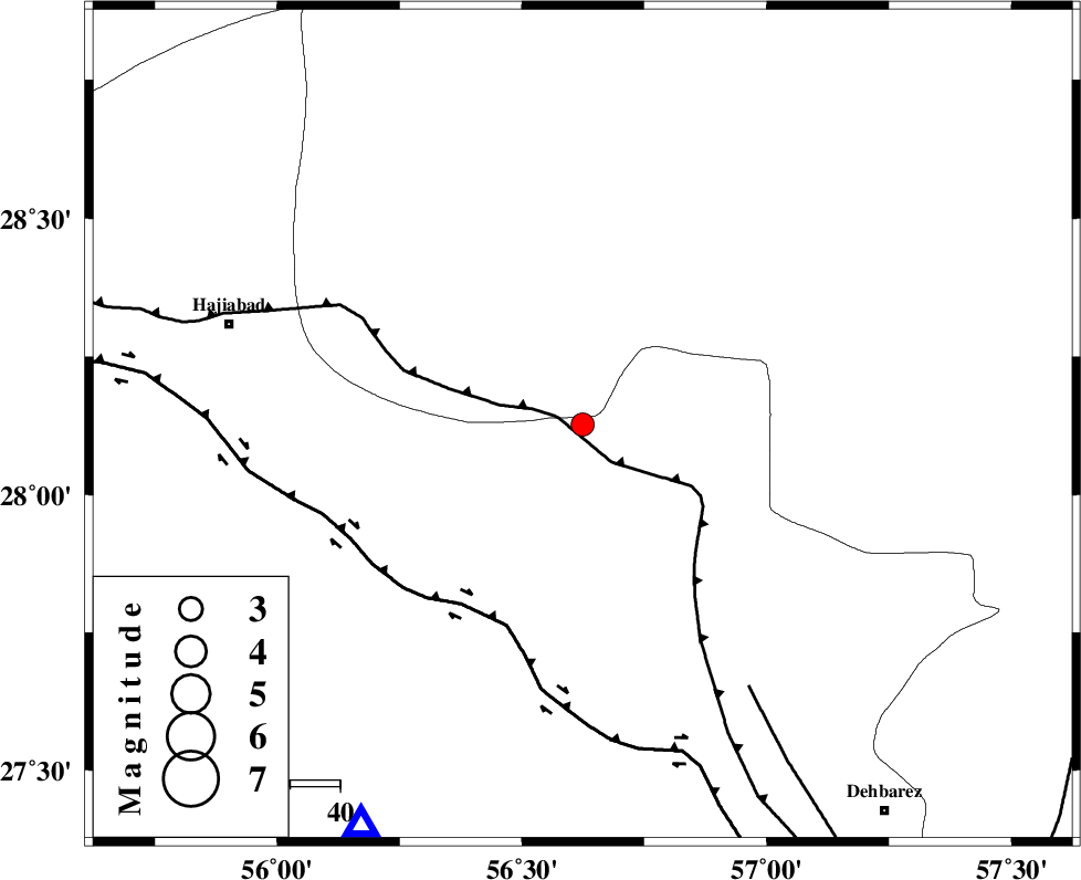
| Location | Lat:28.127 Lon: 56.624 |
| Region | Hormozgan Province, 74 km South-East of Hajiabad |
Nearest Cities |
|
| 34 km South West of Sarkhan, Kerman Province | |
| 40 km North East of Fareqan, Hormozgan Province | |
| 43 km South East of Arzuieeh, Kerman Province | |
| 44 km South East of Shahmaran, Kerman Province | |
| 64 km North West of Faryab, Kerman Province | |
| Depth | 12 km |
| Agency | |
Faults within 150 km: |
|
| MAIN_ZAGROS_R_F (Length: 1106 km) , Distance to epicenter: 4 km | |
| HZF2 (Length: 437 km) , Distance to epicenter: 43 km | |
| ZENDAN_MINAB_F_Z1 (Length: 183 km) , Distance to epicenter: 62 km | |
| Number of Phases | 6 |
| RMS | 0.4 |
| Number of Stations | 6 |
| Error in Latitude | >6.6 km |
| Error in Longitude | 6.6 km |
| Error in Depth | 39.4 km |
Download waveform in seisan format
to download seisan software Click here
to access information about IIEES stations Click here
Amplitude | ||||||||
| UID | Agency | Station | Component | Amplitude | Period | Arrival Time | Proccessing Time | Signal Clip |
| 199413 | IIEES SC | KRBR | Z | 0.3 | 1 | 2025-07-27 22:23:02 | 2025-10-01 07:24:00 | n |
| 199414 | IIEES SC | UOSS | Z | 0.04 | 1 | 2025-07-27 22:23:21 | 2025-10-01 07:24:00 | n |
| 199415 | IIEES SC | BSRN | Z | 0.03 | 1 | 2025-07-27 22:23:38 | 2025-10-01 07:24:00 | n |
Phase | ||||||||||||
| Agency | Station | Component | Phase Type | Phase Quality | First Motion | Observed Arrival Time | Time Residual | Loc. Flag | Input Weight | Distance | Azimuth | |
| IIEES SC | KRBR | Z | EPn | E | 2025-07-27 22:23:02 | -0.2 | y | 0 | 206 | 4 | ||
| IIEES SC | UOSS | Z | EPn | E | 2025-07-27 22:23:21 | 0.2 | y | 0 | 355 | 187 | ||
| IIEES SC | GHIR | Z | EPn | E | 2025-07-27 22:23:36 | 14.4 | n | 4 | 358 | 273 | ||
| IIEES SC | IRSR | Z | EPn | E | 2025-07-27 22:23:31 | -0.2 | y | 0 | 438 | 107 | ||
| IIEES SC | BSRN | Z | EPn | E | 2025-07-27 22:23:38 | 0.7 | y | 0 | 489 | 30 | ||
| IIEES SC | RAYN | Z | EPn | E | 2025-07-27 22:25:08 | -1.2 | y | 0 | 1226 | 245 | ||