
Magnitude |
:3.1 |
| Date & Time (UTC) | 2025-09-28 16:11:50.9 |
| Date & Time (Local) | 1404/7/6 19:41:50.9 |
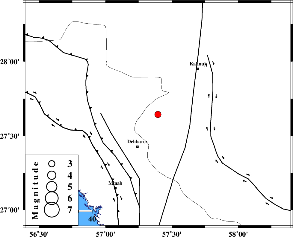
| Location | Lat:27.644 Lon: 57.395 |
| Region | Kerman Province, 28 km North of Manujan |
Nearest Cities |
|
| 8 km North of Bejogan, Kerman Province | |
| 12 km North of Nodezh, Kerman Province | |
| 20 km East of Ziaratali, Hormozgan Province | |
| 22 km South East of Fariab, Hormozgan Province | |
| 26 km North West of Bargah, Kerman Province | |
| Depth | 12 km |
| Agency | |
Faults within 150 km: |
|
| SABZEVARAN_F (Length: 190 km) , Distance to epicenter: 25 km | |
| ZENDAN_MINAB_F_Z1 (Length: 183 km) , Distance to epicenter: 38 km | |
| JIROFT_F (Length: 144 km) , Distance to epicenter: 40 km | |
| Number of Phases | 5 |
| RMS | 0.4 |
| Number of Stations | 5 |
| Error in Latitude | >5 km |
| Error in Longitude | 5 km |
| Error in Depth | 914.8 km |
Download waveform in seisan format
to download seisan software Click here
to access information about IIEES stations Click here
Amplitude | ||||||||
| UID | Agency | Station | Component | Amplitude | Period | Arrival Time | Proccessing Time | Signal Clip |
| 199346 | IIEES SC | KRBR | Z | 0.3 | 1 | 2025-09-28 16:12:32 | 2025-09-29 08:06:00 | n |
| 199347 | IIEES SC | UOSS | Z | 0.05 | 1 | 2025-09-28 16:12:38 | 2025-09-29 08:06:00 | n |
| 199348 | IIEES SC | BSRN | Z | 0.02 | 1 | 2025-09-28 16:13:02 | 2025-09-29 08:06:00 | n |
Phase | ||||||||||||
| Agency | Station | Component | Phase Type | Phase Quality | First Motion | Observed Arrival Time | Time Residual | Loc. Flag | Input Weight | Distance | Azimuth | |
| IIEES SC | KRBR | Z | EPn | E | 2025-09-28 16:12:32 | -0.1 | y | 0 | 266 | 347 | ||
| IIEES SC | UOSS | Z | EPn | E | 2025-09-28 16:12:38 | 0 | y | 0 | 322 | 202 | ||
| IIEES SC | IRSR | Z | EPn | E | 2025-09-28 16:12:42 | 0.2 | y | 0 | 351 | 102 | ||
| IIEES SC | ZHSF | Z | EPn | E | 2025-09-28 16:12:47 | -0.8 | y | 0 | 395 | 57 | ||
| IIEES SC | BSRN | Z | EPn | E | 2025-09-28 16:13:02 | 1 | y | 0 | 507 | 19 | ||