
Magnitude |
:3.6 |
| Date & Time (UTC) | 2025-09-08 09:23:46.6 |
| Date & Time (Local) | 1404/6/17 12:53:46.6 |
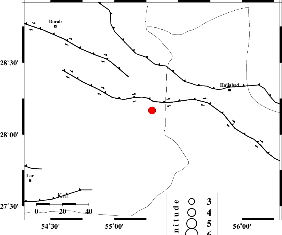
| Location | Lat:28.167 Lon: 55.294 |
| Region | Fars Province, 62 km South-West of Hajiabad |
Nearest Cities |
|
| 11 km East of Fadami, Fars Province | |
| 18 km South of Doborji, Fars Province | |
| 36 km North West of Darz, Fars Province | |
| 38 km South East of Rostaq, Fars Province | |
| 45 km South of Tal bargah, Fars Province | |
| Depth | 12 km |
| Agency | |
Faults within 150 km: |
|
| HZF2 (Length: 437 km) , Distance to epicenter: 7 km | |
| HZF1 (Length: 102 km) , Distance to epicenter: 31 km | |
| MAIN_ZAGROS_R_F (Length: 1106 km) , Distance to epicenter: 34 km | |
| Number of Phases | 12 |
| RMS | 0.3 |
| Number of Stations | 12 |
| Error in Latitude | >1.6 km |
| Error in Longitude | 1.6 km |
| Error in Depth | 387.4 km |
Download waveform in seisan format
to download seisan software Click here
to access information about IIEES stations Click here
Amplitude | ||||||||
| UID | Agency | Station | Component | Amplitude | Period | Arrival Time | Proccessing Time | Signal Clip |
| 199055 | IIEES SC | TABS | Z | 0.03 | 1 | 2025-09-08 09:25:13 | 2025-09-09 06:25:00 | n |
| 199056 | IIEES SC | SHRT | Z | 0.02 | 1 | 2025-09-08 09:25:29 | 2025-09-09 06:25:00 | n |
| 199057 | IIEES SC | SHRO | Z | 0.01 | 1 | 2025-09-08 09:25:43 | 2025-09-09 06:25:00 | n |
Phase | ||||||||||||
| Agency | Station | Component | Phase Type | Phase Quality | First Motion | Observed Arrival Time | Time Residual | Loc. Flag | Input Weight | Distance | Azimuth | |
| IIEES SC | GHIR | Z | EPn | E | 2025-09-08 09:24:22 | 0 | y | 0 | 227 | 273 | ||
| IIEES SC | KRBR | Z | EPn | E | 2025-09-08 09:24:18 | -7.2 | n | 4 | 247 | 35 | ||
| IIEES SC | YZKH | Z | EPn | E | 2025-09-08 09:24:25 | -28.4 | n | 4 | 473 | 352 | ||
| IIEES SC | ZHSF | Z | EPn | E | 2025-09-08 09:25:02 | -1 | y | 0 | 557 | 73 | ||
| IIEES SC | BSRN | Z | EPn | E | 2025-09-08 09:24:48 | -15.8 | n | 4 | 560 | 41 | ||
| IIEES SC | IRSR | Z | EPn | E | 2025-09-08 09:25:04 | 0.1 | y | 0 | 566 | 104 | ||
| IIEES SC | NASN | Z | EPn | E | 2025-09-08 09:25:05 | 0 | y | 0 | 566 | 335 | ||
| IIEES SC | TABS | Z | EPn | E | 2025-09-08 09:25:13 | 0.1 | y | 0 | 632 | 16 | ||
| IIEES SC | SHRT | Z | EPn | E | 2025-09-08 09:25:29 | -0.6 | y | 0 | 773 | 38 | ||
| IIEES SC | SHRO | Z | EPn | E | 2025-09-08 09:25:43 | 0.8 | y | 0 | 872 | 4 | ||
| IIEES SC | RAYN | Z | EPn | E | 2025-09-08 09:26:12 | -0.1 | y | 0 | 1108 | 242 | ||
| IIEES SC | SRSL | Z | EPn | E | 2025-09-08 09:26:34 | 0.1 | y | 0 | 1289 | 314 | ||