
Magnitude |
:4 |
| Date & Time (UTC) | 2025-08-28 18:12:11.5 |
| Date & Time (Local) | 1404/6/6 21:42:11.5 |
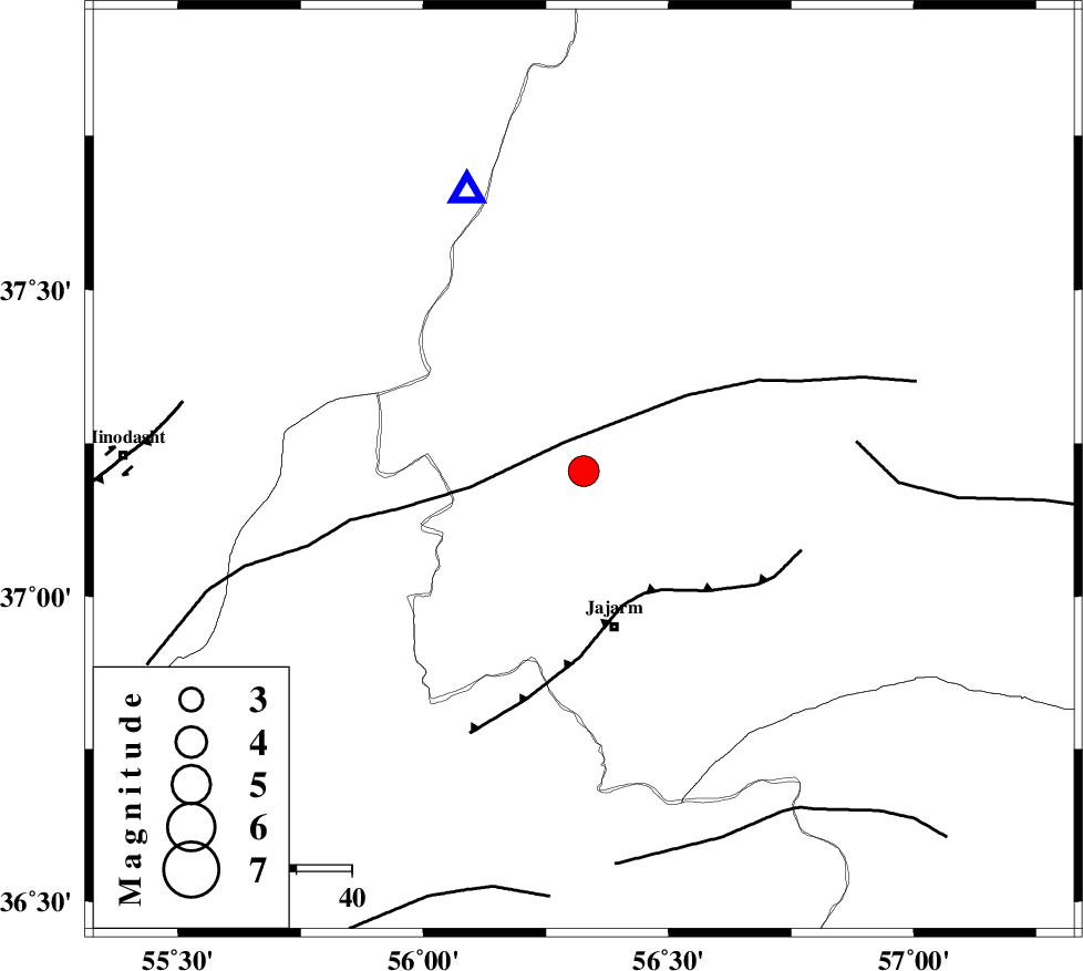
| Location | Lat:37.205 Lon: 56.327 |
| Region | Khorasan(north) Province, 29 km North of Jajarm |
Nearest Cities |
|
| 24 km North of Garmeh, Khorasan(north) Province | |
| 29 km North of Jajarm, Khorasan(north) Province | |
| 48 km South West of Shogan, Khorasan(north) Province | |
| 52 km North East of Nardin, Semnan Province | |
| 57 km North East of Rezvan, Semnan Province | |
| Depth | 12 km |
| Agency | |
Faults within 150 km: |
|
| ROBATE_QARABIL_F (Length: 168 km) , Distance to epicenter: 6 km | |
| JAJARAM_F (Length: 77 km) , Distance to epicenter: 25 km | |
| ESFARAYEN_F (Length: 111 km) , Distance to epicenter: 50 km | |
| Number of Phases | 9 |
| RMS | 0.4 |
| Number of Stations | 9 |
| Error in Latitude | >4.9 km |
| Error in Longitude | 4.9 km |
| Error in Depth | 16.3 km |
Download waveform in seisan format
to download seisan software Click here
to access information about IIEES stations Click here
Amplitude | ||||||||
| UID | Agency | Station | Component | Amplitude | Period | Arrival Time | Proccessing Time | Signal Clip |
| 198965 | IIEES SC | TABS | Z | 0.4 | 1 | 2025-08-28 18:13:09 | 2025-08-31 05:05:00 | n |
| 198966 | IIEES SC | SHRT | Z | 0.1 | 1 | 2025-08-28 18:13:25 | 2025-08-31 05:05:00 | n |
| 198967 | IIEES SC | GHVR | Z | 0.2 | 1 | 2025-08-28 18:13:28 | 2025-08-31 05:05:00 | n |
| 198968 | IIEES SC | NASN | Z | 0.05 | 1 | 2025-08-28 18:13:32 | 2025-08-31 05:05:00 | n |
Phase | ||||||||||||
| Agency | Station | Component | Phase Type | Phase Quality | First Motion | Observed Arrival Time | Time Residual | Loc. Flag | Input Weight | Distance | Azimuth | |
| IIEES SC | BJRD | Z | EPg | E | 2025-08-28 18:12:30 | -0.1 | y | 0 | 110 | 60 | ||
| IIEES SC | ABGH | Z | EPg | E | 2025-08-28 18:12:35 | -0.3 | y | 0 | 146 | 249 | ||
| IIEES SC | KAGH | Z | EPn | E | 2025-08-28 18:13:00 | 0.6 | y | 0 | 324 | 95 | ||
| IIEES SC | TABS | Z | EPn | E | 2025-08-28 18:13:09 | 0.5 | y | 0 | 401 | 170 | ||
| IIEES SC | DAMV | Z | EPn | E | 2025-08-28 18:13:02 | -10 | n | 4 | 428 | 246 | ||
| IIEES SC | SHRT | Z | EPn | E | 2025-08-28 18:13:25 | -0.4 | y | 0 | 534 | 138 | ||
| IIEES SC | GHVR | Z | EPn | E | 2025-08-28 18:13:28 | 1.1 | y | 0 | 550 | 237 | ||
| IIEES SC | YZKH | Z | EPn | E | 2025-08-28 18:13:19 | -9.5 | n | 4 | 557 | 197 | ||
| IIEES SC | NASN | Z | EPn | E | 2025-08-28 18:13:32 | -0.2 | y | 0 | 585 | 213 | ||