
Magnitude |
:3 |
| Date & Time (UTC) | 2025-06-01 16:47:51.1 |
| Date & Time (Local) | 1404/3/11 20:17:51.1 |
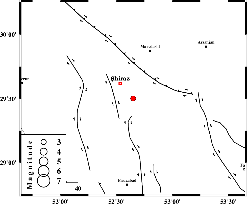
| Location | Lat:29.501 Lon: 52.649 |
| Region | Fars Province, 17 km South-East of Shiraz |
Nearest Cities |
|
| 7 km of Soltanabad, Fars Province | |
| 17 km South East of Shiraz, Fars Province | |
| 24 km North West of Maharlu, Fars Province | |
| 26 km North of Tasuj, Fars Province | |
| 29 km West of Darian, Fars Province | |
| Depth | 12 km |
| Agency | |
Faults within 150 km: |
|
| SABZ_PUSHAN_F_Z1 (Length: 69 km) , Distance to epicenter: 15 km | |
| SABZ_PUSHAN_F_Z3 (Length: 37 km) , Distance to epicenter: 16 km | |
| HZF3 (Length: 197 km) , Distance to epicenter: 24 km | |
| Number of Phases | 6 |
| RMS | 0.5 |
| Number of Stations | 6 |
| Error in Latitude | >10.9 km |
| Error in Longitude | 10.9 km |
| Error in Depth | 38.2 km |
Download waveform in seisan format
to download seisan software Click here
to access information about IIEES stations Click here
Amplitude | ||||||||
| UID | Agency | Station | Component | Amplitude | Period | Arrival Time | Proccessing Time | Signal Clip |
| 198380 | IIEES SC | MEH | Z | 0.05 | 1 | 2025-06-01 16:48:33 | 2025-06-02 07:42:00 | n |
| 198381 | IIEES SC | NASN | Z | 0.04 | 1 | 2025-06-01 16:48:45 | 2025-06-02 07:42:00 | n |
| 198382 | IIEES SC | UOSS | Z | 0.03 | 1 | 2025-06-01 16:49:15 | 2025-06-02 07:42:00 | n |
Phase | ||||||||||||
| Agency | Station | Component | Phase Type | Phase Quality | First Motion | Observed Arrival Time | Time Residual | Loc. Flag | Input Weight | Distance | Azimuth | |
| IIEES SC | GHIR | Z | EPg | E | 2025-06-01 16:48:14 | 0 | y | 0 | 139 | 166 | ||
| IIEES SC | MEH | Z | EPn | E | 2025-06-01 16:48:33 | -0.9 | y | 0 | 282 | 42 | ||
| IIEES SC | NASN | Z | EPn | E | 2025-06-01 16:48:45 | 0.5 | y | 0 | 366 | 2 | ||
| IIEES SC | YZKH | Z | EPn | E | 2025-06-01 16:48:18 | -26.5 | n | 4 | 370 | 30 | ||
| IIEES SC | KRBR | Z | EPn | E | 2025-06-01 16:48:49 | 0.5 | y | 0 | 401 | 82 | ||
| IIEES SC | UOSS | Z | EPn | E | 2025-06-01 16:49:15 | -0.1 | y | 0 | 616 | 145 | ||