
Magnitude |
:3.2 |
| Date & Time (UTC) | 2025-05-02 05:09:20.2 |
| Date & Time (Local) | 1404/2/12 08:39:20.2 |
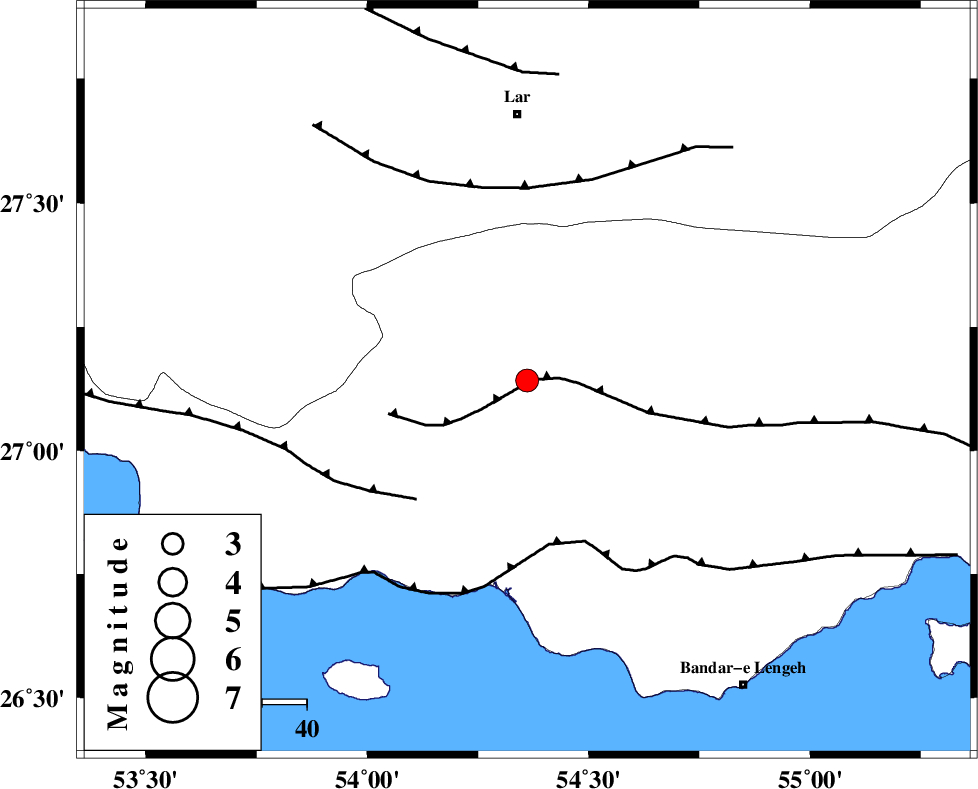
| Location | Lat:27.142 Lon: 54.361 |
| Region | Hormozgan Province, 6 km of Bastak |
Nearest Cities |
|
| 6 km of Bastak, Hormozgan Province | |
| 16 km North of Jenah, Hormozgan Province | |
| 51 km South East of Bagh, Fars Province | |
| 60 km South of Lar, Fars Province | |
| 60 km South East of Grash, Fars Province | |
| Depth | 12 km |
| Agency | |
Faults within 150 km: |
|
| MFF1 (Length: 180 km) , Distance to epicenter: 1 km | |
| MFF3 (Length: 292 km) , Distance to epicenter: 36 km | |
| ZFF1 (Length: 165 km) , Distance to epicenter: 37 km | |
| Number of Phases | 6 |
| RMS | 0.2 |
| Number of Stations | 6 |
| Error in Latitude | >0.5 km |
| Error in Longitude | 0.5 km |
| Error in Depth | 2.8 km |
Download waveform in seisan format
to download seisan software Click here
to access information about IIEES stations Click here
Amplitude | ||||||||
| UID | Agency | Station | Component | Amplitude | Period | Arrival Time | Proccessing Time | Signal Clip |
| 198050 | IIEES SC | UOSS | Z | 0.1 | 1 | 2025-05-02 05:10:05 | 2025-05-03 04:38:00 | n |
| 198051 | IIEES SC | KRBR | Z | 0.1 | 1 | 2025-05-02 05:10:17 | 2025-05-03 04:38:00 | n |
| 198052 | IIEES SC | IRSR | Z | 0.01 | 1 | 2025-05-02 05:10:48 | 2025-05-03 04:38:00 | n |
Phase | ||||||||||||
| Agency | Station | Component | Phase Type | Phase Quality | First Motion | Observed Arrival Time | Time Residual | Loc. Flag | Input Weight | Distance | Azimuth | |
| IIEES SC | GHIR | Z | EPg | E | 2025-05-02 05:09:50 | 0.1 | y | 0 | 186 | 313 | ||
| IIEES SC | UOSS | Z | EPn | E | 2025-05-02 05:10:05 | -0.1 | y | 0 | 305 | 143 | ||
| IIEES SC | KRBR | Z | EPn | E | 2025-05-02 05:10:17 | 0 | y | 0 | 393 | 37 | ||
| IIEES SC | YZKH | Z | EPn | E | 2025-05-02 05:10:14 | -25.8 | n | 4 | 582 | 2 | ||
| IIEES SC | NASN | Z | EPn | E | 2025-05-02 05:10:47 | -0.7 | y | 0 | 645 | 347 | ||
| IIEES SC | IRSR | Z | EPn | E | 2025-05-02 05:10:48 | 0.2 | y | 0 | 645 | 92 | ||