
Magnitude |
:3 |
| Date & Time (UTC) | 2025-04-28 06:59:40.6 |
| Date & Time (Local) | 1404/2/8 10:29:40.6 |
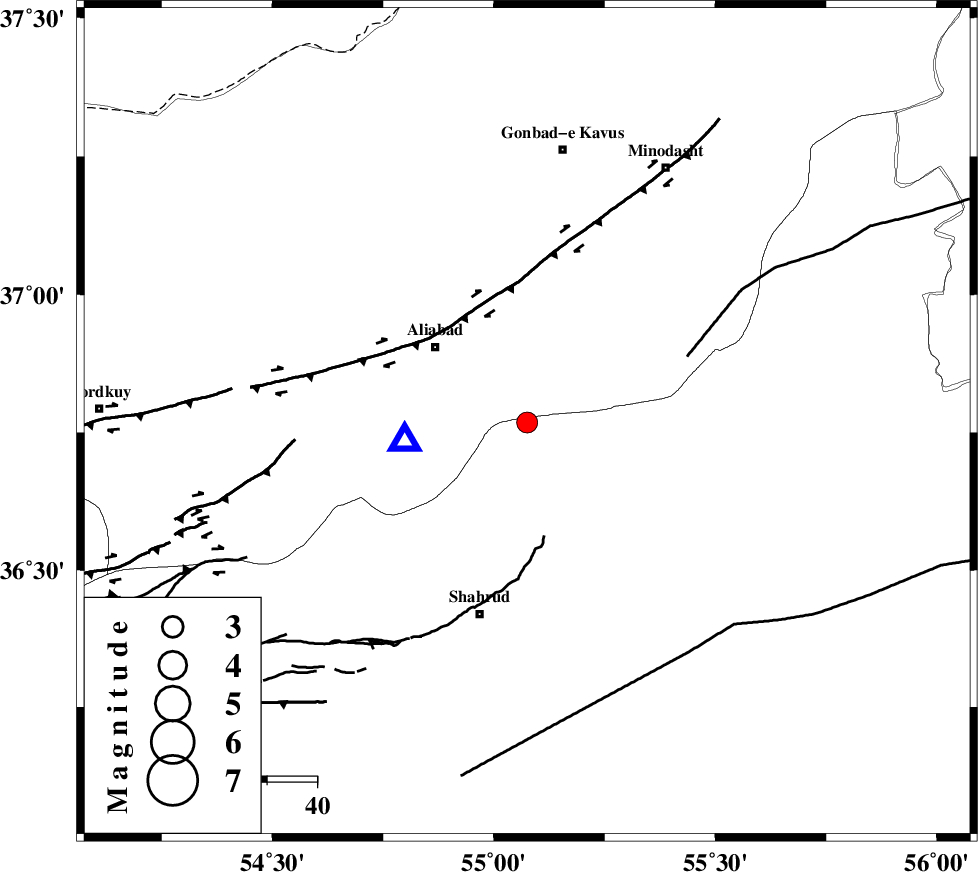
| Location | Lat:36.768 Lon: 55.075 |
| Region | Semnan Province, 28 km South of Ramian |
Nearest Cities |
|
| 15 km North of Qaleh-ye nokharqan, Semnan Province | |
| 24 km North West of Kalateh khanj, Semnan Province | |
| 24 km South East of Ali Abad, Golestan Province | |
| 28 km South of Ramian, Golestan Province | |
| 28 km South of Khanbebin, Golestan Province | |
| Depth | 10 km |
| Agency | |
Faults within 150 km: |
|
| SHAVAR_F (Length: 87 km) , Distance to epicenter: 7 km | |
| KHAZAR_F (Length: 523 km) , Distance to epicenter: 28 km | |
| ROBATE_QARABIL_F (Length: 168 km) , Distance to epicenter: 35 km | |
| Number of Phases | 8 |
| RMS | 0 |
| Number of Stations | 8 |
| Error in Latitude | >0.3 km |
| Error in Longitude | 0.3 km |
| Error in Depth | 0.4 km |
Download waveform in seisan format
to download seisan software Click here
to access information about IIEES stations Click here
Amplitude | ||||||||
| UID | Agency | Station | Component | Amplitude | Period | Arrival Time | Proccessing Time | Signal Clip |
| 198026 | IIEES SC | MRVT | Z | 0.4 | 1 | 2025-04-28 07:00:03 | 2025-04-29 04:56:00 | n |
| 198027 | IIEES SC | GHVR | Z | 0.04 | 1 | 2025-04-28 07:00:42 | 2025-04-29 04:56:00 | n |
Phase | ||||||||||||
| Agency | Station | Component | Phase Type | Phase Quality | First Motion | Observed Arrival Time | Time Residual | Loc. Flag | Input Weight | Distance | Azimuth | |
| IIEES SC | ABGH | Z | EPg | E | 2025-04-28 06:59:45 | 0 | y | 0 | 25 | 261 | ||
| IIEES SC | SHRO | Z | EPg | E | 2025-04-28 07:00:00 | 0 | y | 0 | 119 | 135 | ||
| IIEES SC | MRVT | Z | EPg | E | 2025-04-28 07:00:03 | 0 | y | 0 | 134 | 42 | ||
| IIEES SC | DAMV | Z | EPn | E | 2025-04-28 07:00:11 | -15.7 | n | 4 | 306 | 246 | ||
| IIEES SC | TABS | Z | EPn | E | 2025-04-28 07:00:11 | -25.8 | n | 4 | 393 | 152 | ||
| IIEES SC | GHVR | Z | EPn | E | 2025-04-28 07:00:42 | 0 | y | 0 | 430 | 234 | ||
| IIEES SC | KAGH | Z | EPn | E | 2025-04-28 07:00:43 | 0.1 | y | 0 | 436 | 88 | ||
| IIEES SC | GRMI | Z | EPn | E | 2025-04-28 07:00:39 | -33.2 | n | 4 | 672 | 290 | ||