
Magnitude |
:3.5 |
| Date & Time (UTC) | 2025-03-19 02:14:58.0 |
| Date & Time (Local) | 1403/12/29 05:44:58.0 |
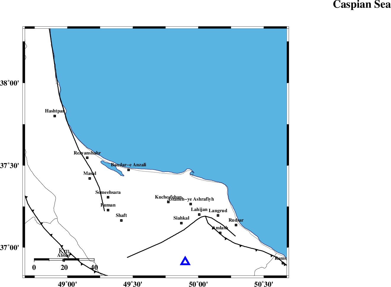
| Location | Lat:37.577 Lon: 49.675 |
| Region | Caspian Sea, 22 km North-East of Bandar-e anzali |
Nearest Cities |
|
| 17 km North of Chaparkhaneh, Gilan Province | |
| 21 km North of Khomam, Gilan Province | |
| 22 km North West of Hajibekandeh, Gilan Province | |
| 22 km North East of Bandar-e anzali, Gilan Province | |
| 23 km North of Katehsar, Gilan Province | |
| Depth | 20 km |
| Agency | |
Faults within 150 km: |
|
| TALESH_F (Length: 258 km) , Distance to epicenter: 45 km | |
| LAHIJAN_F (Length: 92 km) , Distance to epicenter: 53 km | |
| KHAZAR_F (Length: 523 km) , Distance to epicenter: 54 km | |
| Number of Phases | 8 |
| RMS | 0.2 |
| Number of Stations | 8 |
| Error in Latitude | >3 km |
| Error in Longitude | 3 km |
| Error in Depth | 4.9 km |
Download waveform in seisan format
to download seisan software Click here
to access information about IIEES stations Click here
Amplitude | ||||||||
| UID | Agency | Station | Component | Amplitude | Period | Arrival Time | Proccessing Time | Signal Clip |
| 197855 | IIEES SC | CHTH | Z | 0.5 | 1 | 2025-03-19 02:15:33 | 2025-04-12 07:49:00 | n |
| 197856 | IIEES SC | GHVR | Z | 0.3 | 1 | 2025-03-19 02:15:50 | 2025-04-12 07:49:00 | n |
| 197857 | IIEES SC | MRVT | Z | 0.09 | 1 | 2025-03-19 02:16:15 | 2025-04-12 07:49:00 | n |
| 197858 | IIEES SC | BJRD | Z | 0.01 | 1 | 2025-03-19 02:16:30 | 2025-04-12 07:49:00 | n |
Phase | ||||||||||||
| Agency | Station | Component | Phase Type | Phase Quality | First Motion | Observed Arrival Time | Time Residual | Loc. Flag | Input Weight | Distance | Azimuth | |
| IIEES SC | GIDE | Z | EPg | E | 2025-03-19 02:15:10 | 0 | y | 0 | 74 | 170 | ||
| IIEES SC | CHTH | Z | EPn | E | 2025-03-19 02:15:33 | 0.3 | y | 0 | 226 | 145 | ||
| IIEES SC | ASAO | Z | EPn | E | 2025-03-19 02:15:44 | -2.8 | n | 4 | 338 | 175 | ||
| IIEES SC | GHVR | Z | EPn | E | 2025-03-19 02:15:50 | -0.9 | y | 0 | 372 | 158 | ||
| IIEES SC | SRSL | Z | EPn | E | 2025-03-19 02:15:55 | -0.1 | y | 0 | 407 | 248 | ||
| IIEES SC | MRVT | Z | EPn | E | 2025-03-19 02:16:15 | 0.2 | y | 0 | 566 | 89 | ||
| IIEES SC | BJRD | Z | EPn | E | 2025-03-19 02:16:30 | -0.1 | y | 0 | 683 | 89 | ||
| IIEES SC | KAGH | Z | EPn | E | 2025-03-19 02:16:59 | 0.2 | y | 0 | 915 | 94 | ||