
Magnitude |
:3.5 |
| Date & Time (UTC) | 2025-03-30 13:45:04.8 |
| Date & Time (Local) | 1404/1/10 17:15:04.8 |
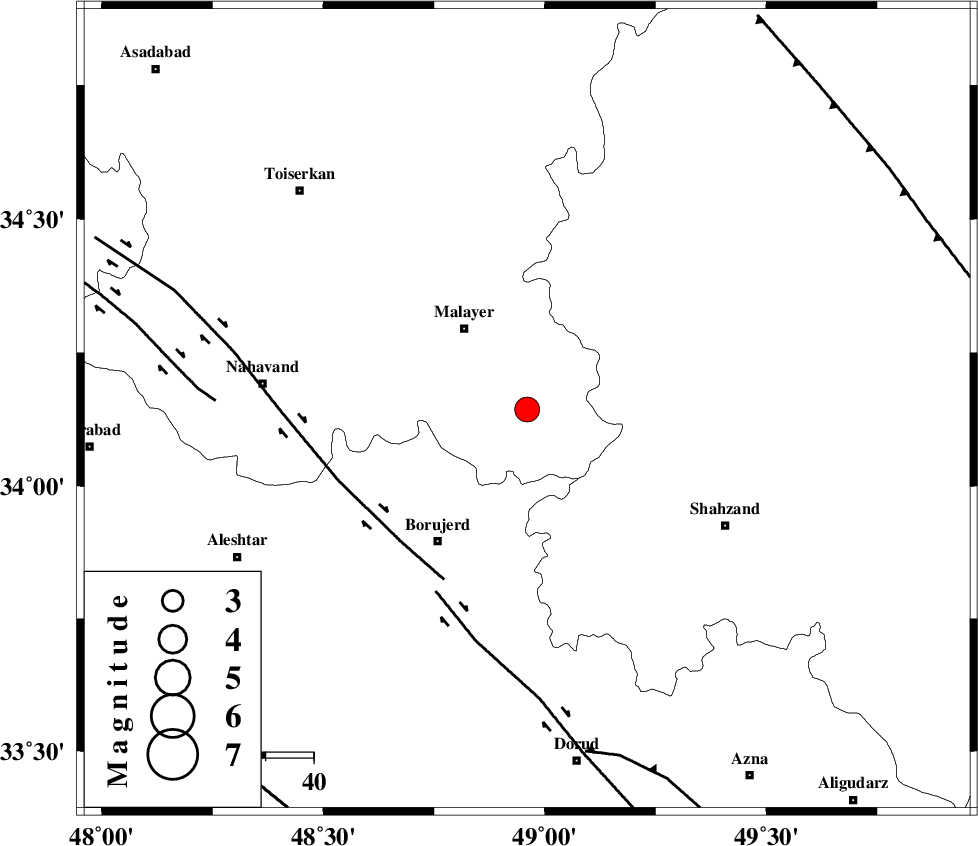
| Location | Lat:34.143 Lon: 48.96 |
| Region | Hamedan Province, 21 km South-East of Malayer |
Nearest Cities |
|
| 8 km North of Pirooz, Hamedan Province | |
| 8 km North of Zangeh olia, Hamedan Province | |
| 11 km North of Mahdaviye, Hamedan Province | |
| 12 km of Jurab, Hamedan Province | |
| 12 km South of Jozan, Hamedan Province | |
| Depth | 7 km |
| Agency | |
Faults within 150 km: |
|
| NAHAVAND_F (Length: 102 km) , Distance to epicenter: 38 km | |
| DORUD (Length: 100 km) , Distance to epicenter: 42 km | |
| SAHANEH_F (Length: 77 km) , Distance to epicenter: 65 km | |
| Number of Phases | 9 |
| RMS | 0.3 |
| Number of Stations | 9 |
| Error in Latitude | >1.6 km |
| Error in Longitude | 1.6 km |
| Error in Depth | 8.3 km |
Download waveform in seisan format
to download seisan software Click here
to access information about IIEES stations Click here
Amplitude | ||||||||
| UID | Agency | Station | Component | Amplitude | Period | Arrival Time | Proccessing Time | Signal Clip |
| 197792 | IIEES SC | ASAO | Z | 2 | 1 | 2025-03-30 13:45:23 | 2025-04-09 04:30:00 | n |
| 197793 | IIEES SC | GHVR | Z | 1 | 1 | 2025-03-30 13:45:39 | 2025-04-09 04:30:00 | n |
| 197794 | IIEES SC | DAMV | Z | 0.2 | 1 | 2025-03-30 13:45:52 | 2025-04-09 04:30:00 | n |
| 197795 | IIEES SC | SRSL | Z | 0.1 | 1 | 2025-03-30 13:46:02 | 2025-04-09 04:30:00 | n |
| 197796 | IIEES SC | TABS | Z | 0.04 | 1 | 2025-03-30 13:46:47 | 2025-04-09 04:30:00 | n |
Phase | ||||||||||||
| Agency | Station | Component | Phase Type | Phase Quality | First Motion | Observed Arrival Time | Time Residual | Loc. Flag | Input Weight | Distance | Azimuth | |
| IIEES SC | ASAO | Z | EPg | E | 2025-03-30 13:45:23 | -0.4 | y | 0 | 108 | 65 | ||
| IIEES SC | GHVR | Z | EPn | E | 2025-03-30 13:45:39 | 0.1 | y | 0 | 214 | 80 | ||
| IIEES SC | CHTH | Z | EPn | E | 2025-03-30 13:45:48 | 0.5 | y | 0 | 278 | 45 | ||
| IIEES SC | GIDE | Z | EPn | E | 2025-03-30 13:45:52 | -0.2 | y | 0 | 318 | 14 | ||
| IIEES SC | DAMV | Z | EPn | E | 2025-03-30 13:45:52 | -0.6 | y | 0 | 321 | 59 | ||
| IIEES SC | SRSL | Z | EPn | E | 2025-03-30 13:46:02 | 0 | y | 0 | 395 | 306 | ||
| IIEES SC | YZKH | Z | EPn | E | 2025-03-30 13:46:23 | 0.2 | y | 0 | 560 | 110 | ||
| IIEES SC | GHIR | Z | EPn | E | 2025-03-30 13:46:46 | -0.2 | y | 0 | 754 | 149 | ||
| IIEES SC | TABS | Z | EPn | E | 2025-03-30 13:46:47 | 0.4 | y | 0 | 757 | 94 | ||