
Magnitude |
:3.2 |
| Date & Time (UTC) | 2025-03-25 02:43:15.6 |
| Date & Time (Local) | 1404/1/5 06:13:15.6 |
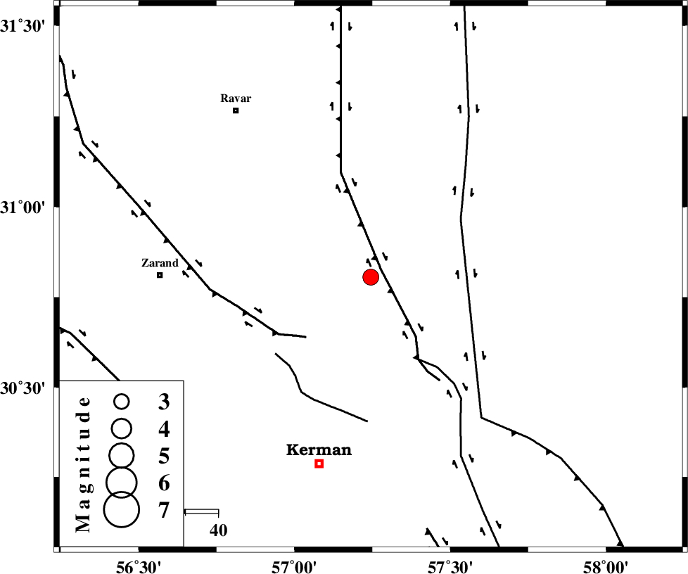
| Location | Lat:30.805 Lon: 57.245 |
| Region | Kerman Province, 65 km -East of Zarand |
Nearest Cities |
|
| 20 km North East of Harjand, Kerman Province | |
| 26 km North East of Hejdak, Kerman Province | |
| 34 km North of Dehlulu, Kerman Province | |
| 39 km North East of Hutak, Kerman Province | |
| 39 km North East of Chatrud, Kerman Province | |
| Depth | 12 km |
| Agency | |
Faults within 150 km: |
|
| LAKARKUH_F (Length: 138 km) , Distance to epicenter: 4 km | |
| KUHBANAN_F (Length: 189 km) , Distance to epicenter: 27 km | |
| GOLBAF_SIRCH_F (Length: 114 km) , Distance to epicenter: 29 km | |
| Number of Phases | 5 |
| RMS | 0.4 |
| Number of Stations | 5 |
| Error in Latitude | >5.7 km |
| Error in Longitude | 5.7 km |
| Error in Depth | 36 km |
Download waveform in seisan format
to download seisan software Click here
to access information about IIEES stations Click here
Amplitude | ||||||||
| UID | Agency | Station | Component | Amplitude | Period | Arrival Time | Proccessing Time | Signal Clip |
| 197699 | IIEES SC | KRBR | Z | 1 | 1 | 2025-03-25 02:43:33 | 2025-04-08 06:44:00 | n |
| 197700 | IIEES SC | YZKH | Z | 0.2 | 1 | 2025-03-25 02:44:01 | 2025-04-08 06:44:00 | n |
| 197701 | IIEES SC | ZHSF | Z | 0.05 | 1 | 2025-03-25 02:44:08 | 2025-04-08 06:44:00 | n |
| 197702 | IIEES SC | SHRT | Z | 0.08 | 1 | 2025-03-25 02:44:16 | 2025-04-08 06:44:00 | n |
Phase | ||||||||||||
| Agency | Station | Component | Phase Type | Phase Quality | First Motion | Observed Arrival Time | Time Residual | Loc. Flag | Input Weight | Distance | Azimuth | |
| IIEES SC | KRBR | Z | EPg | E | 2025-03-25 02:43:33 | 0.3 | y | 0 | 102 | 207 | ||
| IIEES SC | YZKH | Z | EPn | E | 2025-03-25 02:44:01 | -0.3 | y | 0 | 307 | 305 | ||
| IIEES SC | TABS | Z | EPn | E | 2025-03-25 02:44:03 | 0.8 | y | 0 | 316 | 358 | ||
| IIEES SC | ZHSF | Z | EPn | E | 2025-03-25 02:44:08 | -0.1 | y | 0 | 364 | 111 | ||
| IIEES SC | SHRT | Z | EPn | E | 2025-03-25 02:44:16 | -0.4 | y | 0 | 426 | 42 | ||