
Magnitude |
:3 |
| Date & Time (UTC) | 2021-09-10 08:34:54.2 |
| Date & Time (Local) | 1400/6/19 13:04:54.2 |
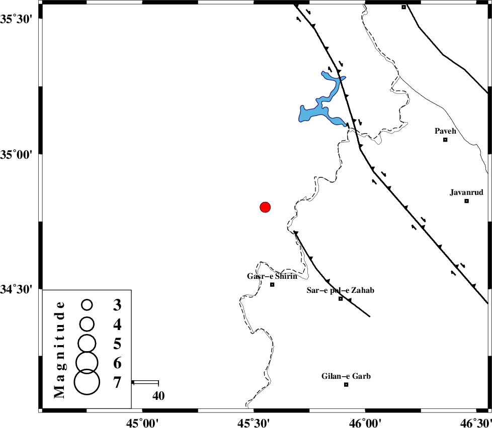
| Location | Lat:34.803 Lon: 45.551 |
| Region | Iraq, 32 km North of Qasr-E-Shirin |
Nearest Cities |
|
| 17 km North West of Tappeh rash, Kermanshah Province | |
| 25 km North West of Gardehnu, Kermanshah Province | |
| 26 km North West of Tazehabad, Kermanshah Province | |
| 31 km North West of Aqabarar, Kermanshah Province | |
| 32 km North of Qasr-E-Shirin, Kermanshah Province | |
| Depth | 12 km |
| Agency | |
Faults within 150 km: |
|
| MFF8 (Length: 48 km) , Distance to epicenter: 15 km | |
| HZF4 (Length: 492 km) , Distance to epicenter: 46 km | |
| PIRANSHAHR_F (Length: 253 km) , Distance to epicenter: 96 km | |
| Number of Phases | 8 |
| RMS | 0.6 |
| Number of Stations | 8 |
| Error in Latitude | >5.9 km |
| Error in Longitude | 5.9 km |
| Error in Depth | 7.5 km |
Download waveform in seisan format
to download seisan software Click here
to access information about IIEES stations Click here
Amplitude | ||||||||
| UID | Agency | Station | Component | Amplitude | Period | Arrival Time | Proccessing Time | Signal Clip |
| 165106 | IIEES SC | SRSL | Z | 0.3 | 1 | 2021-09-10 08:35:20 | 2021-09-11 05:29:00 | n |
| 165107 | IIEES SC | MAHB | Z | 0.3 | 1 | 2021-09-10 08:35:28 | 2021-09-11 05:29:00 | n |
| 165108 | IIEES SC | MAHB | Z | 0.3 | 1 | 2021-09-10 08:35:55 | 2021-09-11 05:29:00 | n |
| 165109 | IIEES SC | GTMR | Z | 0.05 | 1 | 2021-09-10 08:35:53 | 2021-09-11 05:29:00 | n |
Phase | ||||||||||||
| Agency | Station | Component | Phase Type | Phase Quality | First Motion | Observed Arrival Time | Time Residual | Loc. Flag | Input Weight | Distance | Azimuth | |
| IIEES SC | ILBA | Z | EPg | E | 2021-09-10 08:35:18 | 0.3 | y | 0 | 144 | 155 | ||
| IIEES SC | ILBA | Z | ESg | E | 2021-09-10 08:35:36 | 0.5 | y | 0 | 144 | 155 | ||
| IIEES SC | SRSL | Z | EPg | E | 2021-09-10 08:35:20 | 0.5 | y | 0 | 157 | 356 | ||
| IIEES SC | SNGE | Z | EPg | E | 2021-09-10 08:35:21 | -0.4 | y | 0 | 167 | 79 | ||
| IIEES SC | MAHB | Z | EPn | E | 2021-09-10 08:35:28 | -0.8 | y | 0 | 218 | 4 | ||
| IIEES SC | MAHB | Z | ES | E | 2021-09-10 08:35:55 | 0.5 | y | 0 | 218 | 4 | ||
| IIEES SC | GTMR | Z | EPn | E | 2021-09-10 08:35:53 | -1 | y | 0 | 420 | 128 | ||
| IIEES SC | GRMI | Z | EPn | E | 2021-09-10 08:35:57 | -5.5 | n | 4 | 491 | 25 | ||