
Magnitude |
:2.9 |
| Date & Time (UTC) | 2018-04-07 12:28:55.9 |
| Date & Time (Local) | 1397/1/18 16:58:55.9 |
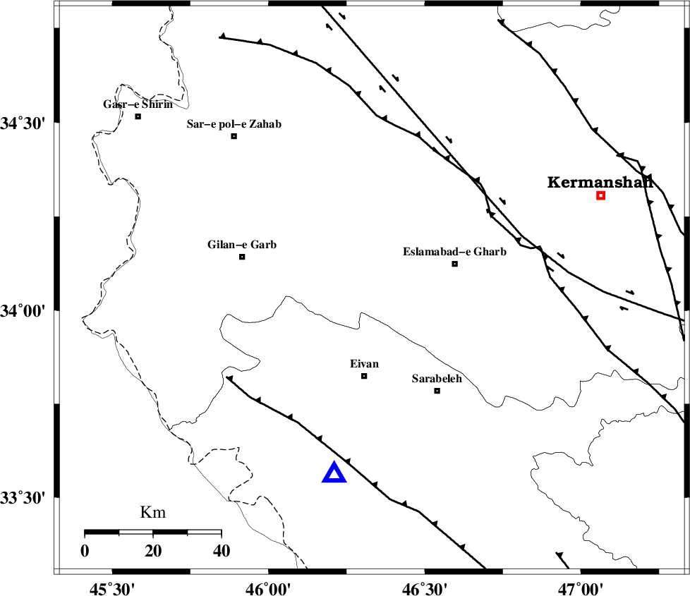
| Location | Lat:34.058 Lon: 46.331 |
| Region | Kermanshah Province, 26 km North of Eyvan |
Nearest Cities |
|
| 6 km North of Sarmast, Kermanshah Province | |
| 15 km South of Khosroabad, Kermanshah Province | |
| 18 km South of Telesm, Kermanshah Province | |
| 20 km North East of Zarneh, Ilam Province | |
| 21 km East of Qamarali, Kermanshah Province | |
| Depth | 14 km |
| Agency | |
Faults within 150 km: |
|
| HZF4 (Length: 492 km) , Distance to epicenter: 43 km | |
| MFF8 (Length: 48 km) , Distance to epicenter: 47 km | |
| MFF7 (Length: 99 km) , Distance to epicenter: 53 km | |
| Number of Phases | 8 |
| RMS | 0.3 |
| Number of Stations | 5 |
| Error in Latitude | >1.8 km |
| Error in Longitude | 4 km |
| Error in Depth | 6.5 km |
Download waveform in seisan format
to download seisan software Click here
to access information about IIEES stations Click here
Amplitude | ||||||||
| UID | Agency | Station | Component | Amplitude | Period | Arrival Time | Proccessing Time | Signal Clip |
| 130057 | IIEES | ILBA | E | 1078.5 | 0.43 | 2018-04-07 12:29:12 | 2018-04-08 04:29:00 | n |
| 130058 | IIEES | ILBA | N | 1222.8 | 0.34 | 2018-04-07 12:29:12 | 2018-04-08 04:29:00 | n |
| 130059 | IIEES | SNGE | N | 123.9 | 0.71 | 2018-04-07 12:29:42 | 2018-04-08 04:29:00 | n |
| 130060 | IIEES | SRSL | N | 52.1 | 0.55 | 2018-04-07 12:30:14 | 2018-04-08 04:29:00 | n |
| 130061 | IIEES | SRSL | E | 66.2 | 0.39 | 2018-04-07 12:30:17 | 2018-04-08 04:29:00 | n |
Phase | ||||||||||||
| Agency | Station | Component | Phase Type | Phase Quality | First Motion | Observed Arrival Time | Time Residual | Loc. Flag | Input Weight | Distance | Azimuth | |
| IIEES | ILBA | Z | Pg | E | 2018-04-07 12:29:04 | -0.4 | y | 49.4 | 193 | |||
| IIEES | ILBA | N | Sg | E | 2018-04-07 12:29:11 | 0.11 | y | 49.4 | 193 | |||
| IIEES | SNGE | Z | Pg | E | 2018-04-07 12:29:20 | -0.23 | y | 148 | 39 | |||
| IIEES | SNGE | N | Sg | E | 2018-04-07 12:29:38 | -0.29 | y | 148 | 39 | |||
| IIEES | SRSL | Z | Pn | E | 2018-04-07 12:29:35 | 0.1 | y | 253 | 341 | |||
| IIEES | SRSL | N | Sg | E | 2018-04-07 12:30:07 | 0.11 | y | 253 | 341 | |||
| IIEES | KHMZ | Z | Pn | E | 2018-04-07 12:29:45 | -0.02 | y | 338 | 95 | |||
| IIEES | ASAO | Z | Pn | E | 2018-04-07 12:29:47 | 0.71 | y | 344 | 80 | |||