
Magnitude |
:3.4 |
| Date & Time (UTC) | 2017-11-12 18:52:15.9 |
| Date & Time (Local) | 1396/8/21 22:22:15.9 |
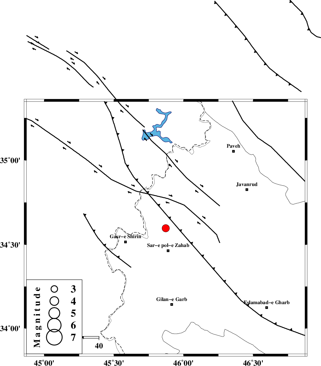
| Location | Lat:34.597 Lon: 45.872 |
| Region | Kermanshah Province, 15 km North of Sar-e pol-e zahab |
Nearest Cities |
|
| 5 km of Bazmirabad, Kermanshah Province | |
| 10 km North East of Mirmiru, Kermanshah Province | |
| 14 km South of Gardehnu, Kermanshah Province | |
| 15 km North of Sar-e pol-e zahab, Kermanshah Province | |
| 15 km North of Qareh belagh, Kermanshah Province | |
| Depth | 14 km |
| Agency | |
Faults within 150 km: |
|
| MFF8 (Length: 48 km) , Distance to epicenter: 9 km | |
| HZF4 (Length: 492 km) , Distance to epicenter: 37 km | |
| MFF7 (Length: 99 km) , Distance to epicenter: 80 km | |
| Number of Phases | 4 |
| RMS | 0.2 |
| Number of Stations | 3 |
| Error in Latitude | >9.7 km |
| Error in Longitude | 9.4 km |
| Error in Depth | 9.6 km |
Download waveform in seisan format
to download seisan software Click here
to access information about IIEES stations Click here
Amplitude | ||||||||
| UID | Agency | Station | Component | Amplitude | Period | Arrival Time | Proccessing Time | Signal Clip |
| 122682 | IIEES | SNGE | N | 793.4 | 0.2 | 2017-11-12 18:53:02 | 2017-11-26 11:39:00 | n |
| 122683 | IIEES | ASAO | E | 61.7 | 0.56 | 2017-11-12 18:54:14 | 2017-11-26 11:39:00 | n |
| 122684 | IIEES | ASAO | N | 53.1 | 0.7 | 2017-11-12 18:54:17 | 2017-11-26 11:39:00 | n |
Phase | ||||||||||||
| Agency | Station | Component | Phase Type | Phase Quality | First Motion | Observed Arrival Time | Time Residual | Loc. Flag | Input Weight | Distance | Azimuth | |
| IIEES | SNGE | Z | Pg | E | 2017-11-12 18:52:39 | -0.35 | y | 146 | 67 | |||
| IIEES | SNGE | N | Sg | E | 2017-11-12 18:52:58 | 0.13 | y | 146 | 67 | |||
| IIEES | ZNJK | Z | Pn | E | 2017-11-12 18:53:06 | 0.13 | y | 343 | 47 | |||
| IIEES | ASAO | Z | Pn | E | 2017-11-12 18:53:11 | 0.13 | y | 381 | 90 | |||