
Magnitude |
:2.8 |
| Date & Time (UTC) | 2017-07-24 11:17:20.6 |
| Date & Time (Local) | 1396/5/2 15:47:20.6 |
| Location | Lat:38.588 Lon: 44.927 |
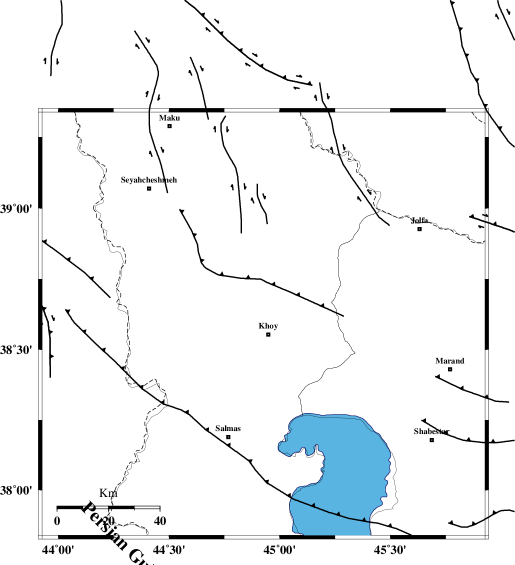
| Region | Azarbaijan Gharbi Province, 4 km of Khoy |
Nearest Cities |
|
| 4 km North of Khoy, Azarbaijan Gharbi Province | |
| 7 km of Dizaj, Azarbaijan Gharbi Province | |
| 9 km North of Saeedabad, Azarbaijan Gharbi Province | |
| 12 km North East of Beyk sofla, Azarbaijan Gharbi Province | |
| 16 km North of Quruq, Azarbaijan Gharbi Province | |
| Depth | 16 km |
| Agency | |
Faults within 150 km: |
|
| KHOY (Length: 100 km) , Distance to epicenter: 3 km | |
| N_TABRIZ_F3 (Length: 66 km) , Distance to epicenter: 32 km | |
| N_TABRIZ_F1 (Length: 222 km) , Distance to epicenter: 38 km | |
| Number of Phases | 5 |
| RMS | 0 |
| Number of Stations | 4 |
| Error in Latitude | >3.3 km |
| Error in Longitude | 2.2 km |
| Error in Depth | 5.5 km |
Download waveform in seisan format
to download seisan software Click here
to access information about IIEES stations Click here
Amplitude | ||||||||
| UID | Agency | Station | Component | Amplitude | Period | Arrival Time | Proccessing Time | Signal Clip |
| 118056 | IIEES | MAKU | N | 346.3 | 0.44 | 2017-07-24 11:17:55 | 2017-07-26 10:53:00 | n |
| 118057 | IIEES | GRMI | N | 48.4 | 0.64 | 2017-07-24 11:18:40 | 2017-07-26 10:53:00 | n |
| 118058 | IIEES | GRMI | E | 46.6 | 0.56 | 2017-07-24 11:18:41 | 2017-07-26 10:53:00 | n |
| 118059 | IIEES | SNGE | E | 8.5 | 0.7 | 2017-07-24 11:19:25 | 2017-07-26 10:53:00 | n |
Phase | ||||||||||||
| Agency | Station | Component | Phase Type | Phase Quality | First Motion | Observed Arrival Time | Time Residual | Loc. Flag | Input Weight | Distance | Azimuth | |
| IIEES | MAKU | Z | Pg | E | 2017-07-24 11:17:35 | 0 | y | 87.7 | 346 | |||
| IIEES | GRMI | Z | Pn | E | 2017-07-24 11:18:00 | 0 | y | 259 | 84 | |||
| IIEES | GRMI | N | Sg | E | 2017-07-24 11:18:33 | 0 | y | 259 | 84 | |||
| IIEES | ZNJK | Z | P | E | 2017-07-24 11:18:17 | -0.01 | y | 394 | 122 | |||
| IIEES | SNGE | Z | Pn | E | 2017-07-24 11:18:23 | 0.01 | y | 444 | 150 | |||