
Magnitude |
:2.8 |
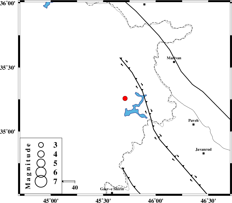
| Date & Time (UTC) | 2017-07-04 02:25:58.7 |
| Date & Time (Local) | 1396/4/13 06:55:58.7 |
| Location | Lat:35.258 Lon: 45.707 |
| Region | Iraq, 41 km South-East of Sulaymaniyah |
Nearest Cities |
|
| 31 km North West of Markhil, Kermanshah Province | |
| 41 km South East of Sulaymaniyah, Iraq Province | |
| 44 km South West of Ney, Kurdistan Province | |
| 47 km North West of Nosud, Kermanshah Province | |
| 49 km South West of Kanidinar, Kurdistan Province | |
| Depth | 6 km |
| Agency | |
Faults within 150 km: |
|
| HZF4 (Length: 492 km) , Distance to epicenter: 16 km | |
| PIRANSHAHR_F (Length: 253 km) , Distance to epicenter: 54 km | |
| MFF8 (Length: 48 km) , Distance to epicenter: 60 km | |
| Number of Phases | 5 |
| RMS | 0.3 |
| Number of Stations | 3 |
| Error in Latitude | >3.6 km |
| Error in Longitude | 6.4 km |
| Error in Depth | 8.2 km |
Download waveform in seisan format
to download seisan software Click here
to access information about IIEES stations Click here
Amplitude | ||||||||
| UID | Agency | Station | Component | Amplitude | Period | Arrival Time | Proccessing Time | Signal Clip |
| 117336 | IIEES | ILBA | N | 117.9 | 0.4 | 2017-07-04 02:26:57 | 2017-07-04 05:31:00 | n |
| 117337 | IIEES | ILBA | E | 77.3 | 0.31 | 2017-07-04 02:26:57 | 2017-07-04 05:31:00 | n |
Phase | ||||||||||||
| Agency | Station | Component | Phase Type | Phase Quality | First Motion | Observed Arrival Time | Time Residual | Loc. Flag | Input Weight | Distance | Azimuth | |
| IIEES | SNGE | Z | Pg | E | 2017-07-04 02:26:24 | -0.36 | y | 151 | 97 | |||
| IIEES | SNGE | N | S | E | 2017-07-04 02:26:42 | 0.08 | y | 151 | 97 | |||
| IIEES | ILBA | Z | Pg | E | 2017-07-04 02:26:30 | -0.25 | y | 187 | 166 | |||
| IIEES | ILBA | N | Sg | E | 2017-07-04 02:26:54 | 0.23 | y | 187 | 166 | |||
| IIEES | ZNJK | Z | Pn | E | 2017-07-04 02:26:46 | 0.33 | y | 311 | 59 | |||