
Magnitude |
:3.7 |
| Date & Time (UTC) | 2017-06-28 02:53:09.7 |
| Date & Time (Local) | 1396/4/7 07:23:09.7 |
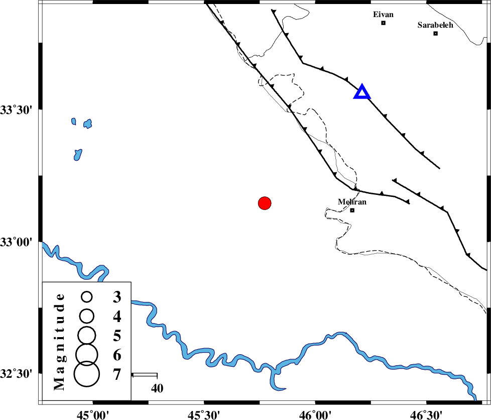
| Location | Lat:33.146 Lon: 45.772 |
| Region | Iraq, 37 km -West of Mehran |
Nearest Cities |
|
| 37 km North West of Mehran, Ilam Province | |
| 53 km South West of Salehabad, Ilam Province | |
| 65 km South West of Galeh-yedarre-hemalakshahi, Ilam Province | |
| 73 km South West of Mehr, Ilam Province | |
| 74 km South West of Gonbad-e pirmohammad, Ilam Province | |
| Depth | 14 km |
| Agency | |
Faults within 150 km: |
|
| ZFF4 (Length: 128 km) , Distance to epicenter: 31 km | |
| MFF6 (Length: 144 km) , Distance to epicenter: 54 km | |
| MFF7 (Length: 99 km) , Distance to epicenter: 61 km | |
| Number of Phases | 6 |
| RMS | 0.1 |
| Number of Stations | 5 |
| Error in Latitude | >4.8 km |
| Error in Longitude | 9.1 km |
| Error in Depth | 6.6 km |
Download waveform in seisan format
to download seisan software Click here
to access information about IIEES stations Click here
Amplitude | ||||||||
| UID | Agency | Station | Component | Amplitude | Period | Arrival Time | Proccessing Time | Signal Clip |
| 117107 | IIEES | ILBA | N | 2663 | 0.72 | 2017-06-28 02:53:37 | 2017-06-28 04:01:00 | n |
| 117108 | IIEES | SNGE | N | 449.7 | 0.52 | 2017-06-28 02:54:29 | 2017-06-28 04:01:00 | n |
| 117109 | IIEES | SNGE | E | 328.5 | 0.56 | 2017-06-28 02:54:30 | 2017-06-28 04:01:00 | n |
| 117110 | IIEES | GHVR | E | 41.6 | 0.68 | 2017-06-28 02:55:22 | 2017-06-28 04:01:00 | n |
Phase | ||||||||||||
| Agency | Station | Component | Phase Type | Phase Quality | First Motion | Observed Arrival Time | Time Residual | Loc. Flag | Input Weight | Distance | Azimuth | |
| IIEES | ILBA | Z | Pg | E | 2017-06-28 02:53:21 | -0.24 | y | 66.8 | 37 | |||
| IIEES | SNGE | Z | Pn | E | 2017-06-28 02:53:49 | 0.11 | y | 260 | 34 | |||
| IIEES | SNGE | N | Sg | E | 2017-06-28 02:54:23 | 0.06 | y | 260 | 34 | |||
| IIEES | ASAO | Z | Pn | E | 2017-06-28 02:54:10 | 0.15 | y | 423 | 67 | |||
| IIEES | ZNJK | Z | Pn | E | 2017-06-28 02:54:16 | 0.05 | y | 473 | 33 | |||
| IIEES | GHVR | Z | Pn | E | 2017-06-28 02:54:22 | -0.11 | y | 528 | 72 | |||