
Magnitude |
:3.1 |
| Date & Time (UTC) | 2016-11-14 09:47:12.9 |
| Date & Time (Local) | 1395/8/24 13:17:12.9 |
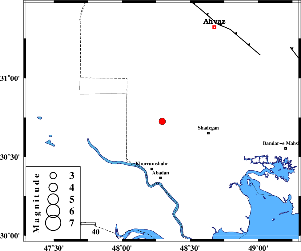
| Location | Lat:30.726 Lon: 48.295 |
| Region | Khoozestan Province, 40 km North of Abadan |
Nearest Cities |
|
| 13 km West of Darkhovin, Khoozestan Province | |
| 32 km North East of Polno, Khoozestan Province | |
| 33 km North West of Shadegan, Khoozestan Province | |
| 34 km North of Khorramshahr, Khoozestan Province | |
| 40 km North of Abadan, Khoozestan Province | |
| Depth | 15 km |
| Agency | |
Faults within 150 km: |
|
| AHVAZ_F (Length: 99 km) , Distance to epicenter: 79 km | |
| AGHAJARI_F (Length: 88 km) , Distance to epicenter: 104 km | |
| RAG_E_SEFID_F (Length: 84 km) , Distance to epicenter: 143 km | |
| Number of Phases | 7 |
| RMS | 0.2 |
| Number of Stations | 7 |
| Error in Latitude | >3.5 km |
| Error in Longitude | 2.1 km |
| Error in Depth | 0 km |
Download waveform in seisan format
to download seisan software Click here
to access information about IIEES stations Click here
Amplitude | ||||||||
| UID | Agency | Station | Component | Amplitude | Period | Arrival Time | Proccessing Time | Signal Clip |
| 110695 | IIEES | AHRM | E | 57 | 0.93 | 2016-11-14 09:49:06 | 2016-11-14 02:26:00 | n |
| 110696 | IIEES | ASAO | N | 10.9 | 0.49 | 2016-11-14 09:49:33 | 2016-11-14 02:26:00 | n |
| 110697 | IIEES | SNGE | E | 6.6 | 0.46 | 2016-11-14 09:49:17 | 2016-11-14 02:26:00 | n |
| 110698 | IIEES | GHVR | E | 18.5 | 0.54 | 2016-11-14 09:49:21 | 2016-11-14 02:26:00 | n |
| 110699 | IIEES | GHVR | N | 13.8 | 0.54 | 2016-11-14 09:49:29 | 2016-11-14 02:26:00 | n |
Phase | ||||||||||||
| Agency | Station | Component | Phase Type | Phase Quality | First Motion | Observed Arrival Time | Time Residual | Loc. Flag | Input Weight | Distance | Azimuth | |
| IIEES | AHRM | Z | Pn | E | 2016-11-14 09:48:04 | 0.09 | y | 356 | 125 | |||
| IIEES | KHMZ | Z | Pn | E | 2016-11-14 09:48:06 | 0.12 | y | 369 | 25 | |||
| IIEES | ILBA | Z | Pn | E | 2016-11-14 09:48:07 | -0.09 | y | 377 | 329 | |||
| IIEES | ASAO | Z | Pn | E | 2016-11-14 09:48:17 | 0.11 | y | 454 | 21 | |||
| IIEES | NASN | Z | Pn | E | 2016-11-14 09:48:20 | -0.45 | y | 485 | 61 | |||
| IIEES | SNGE | Z | Pn | E | 2016-11-14 09:48:21 | -0.06 | y | 492 | 350 | |||
| IIEES | GHVR | Z | Pn | E | 2016-11-14 09:48:22 | 0.25 | y | 500 | 33 | |||