
Magnitude |
:3 |
| Date & Time (UTC) | 2016-10-31 16:04:36.4 |
| Date & Time (Local) | 1395/8/10 19:34:36.4 |
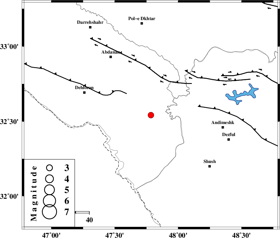
| Location | Lat:32.542 Lon: 47.785 |
| Region | Ilam Province, 54 km -West of Andimeshk |
Nearest Cities |
|
| 40 km East of Musian, Ilam Province | |
| 45 km South East of Sarabbagh, Ilam Province | |
| 46 km South West of Hoseinieh, Khoozestan Province | |
| 49 km South West of Bidruyeh, Khoozestan Province | |
| 52 km South East of Dehloran, Ilam Province | |
| Depth | 14 km |
| Agency | |
Faults within 150 km: |
|
| MFF6 (Length: 144 km) , Distance to epicenter: 24 km | |
| BALARUD_F_Z1 (Length: 87 km) , Distance to epicenter: 28 km | |
| DEZFUL_EMBAYMENT (Length: 228 km) , Distance to epicenter: 35 km | |
| Number of Phases | 8 |
| RMS | 0.2 |
| Number of Stations | 6 |
| Error in Latitude | >4.6 km |
| Error in Longitude | 4.5 km |
| Error in Depth | 9.8 km |
Download waveform in seisan format
to download seisan software Click here
to access information about IIEES stations Click here
Amplitude | ||||||||
| UID | Agency | Station | Component | Amplitude | Period | Arrival Time | Proccessing Time | Signal Clip |
| 110441 | IIEES | KHMZ | N | 72.6 | 0.48 | 2016-10-31 16:05:49 | 2016-11-01 05:39:00 | n |
| 110442 | IIEES | ASAO | E | 35.4 | 0.46 | 2016-10-31 16:06:08 | 2016-11-01 05:39:00 | n |
| 110443 | IIEES | ASAO | N | 55.1 | 0.46 | 2016-10-31 16:06:08 | 2016-11-01 05:39:00 | n |
| 110444 | IIEES | GHVR | N | 19.6 | 0.33 | 2016-10-31 16:06:21 | 2016-11-01 05:39:00 | n |
| 110445 | IIEES | GHVR | E | 26.3 | 0.51 | 2016-10-31 16:06:29 | 2016-11-01 05:39:00 | n |
Phase | ||||||||||||
| Agency | Station | Component | Phase Type | Phase Quality | First Motion | Observed Arrival Time | Time Residual | Loc. Flag | Input Weight | Distance | Azimuth | |
| IIEES | ILAM | Z | Pg | E | 2016-10-31 16:05:07 | -0.33 | y | 190 | 310 | |||
| IIEES | ILAM | N | Sg | E | 2016-10-31 16:05:30 | 0.21 | y | 190 | 310 | |||
| IIEES | KHMZ | Z | Pn | E | 2016-10-31 16:05:14 | 0.06 | y | 243 | 56 | |||
| IIEES | SNGE | Z | Pn | E | 2016-10-31 16:05:20 | 0.34 | y | 286 | 352 | |||
| IIEES | SNGE | E | Sg | E | 2016-10-31 16:05:56 | -0.1 | y | 286 | 352 | |||
| IIEES | ASAO | Z | Pn | E | 2016-10-31 16:05:22 | 0.08 | y | 305 | 42 | |||
| IIEES | GHVR | Z | Pn | E | 2016-10-31 16:05:32 | -0.03 | y | 387 | 55 | |||
| IIEES | ZNJK | Z | Pn | E | 2016-10-31 16:05:41 | -0.29 | y | 465 | 10 | |||