
Magnitude |
:3.3 |
| Date & Time (UTC) | 2016-01-29 05:35:44.0 |
| Date & Time (Local) | 1394/11/9 09:05:44.0 |
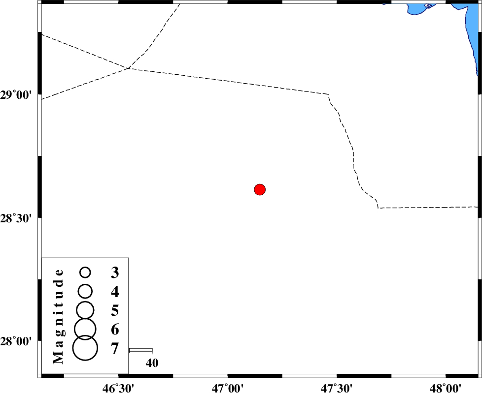
| Location | Lat:28.614 Lon: 47.147 |
| Region | Saudi |
Nearest Cities |
|
| 117 km South West of Kuwait, Kuwait Province | |
| 212 km South West of Arvandkenar, Khoozestan Province | |
| 221 km South West of Al Basrah, Iraq Province | |
| 222 km South West of Farrokhzad, Khoozestan Province | |
| 224 km South West of Abadan, Khoozestan Province | |
| Depth | 15 km |
| Agency | |
Faults within 150 km: |
|
| Number of Phases | 7 |
| RMS | 0.1 |
| Number of Stations | 7 |
| Error in Latitude | >14 km |
| Error in Longitude | 2.7 km |
| Error in Depth | 0 km |
Download waveform in seisan format
to download seisan software Click here
to access information about IIEES stations Click here
Amplitude | ||||||||
| UID | Agency | Station | Component | Amplitude | Period | Arrival Time | Proccessing Time | Signal Clip |
| 104049 | IIEES | GHIR | E | 11.9 | 0.86 | 2016-01-29 05:38:56 | 2016-01-30 08:14:00 | n |
| 104050 | IIEES | KHMZ | N | 8.7 | 0.42 | 2016-01-29 05:38:43 | 2016-01-30 08:14:00 | n |
| 104051 | IIEES | KHMZ | E | 8.2 | 0.56 | 2016-01-29 05:38:47 | 2016-01-30 08:14:00 | n |
Phase | ||||||||||||
| Agency | Station | Component | Phase Type | Phase Quality | First Motion | Observed Arrival Time | Time Residual | Loc. Flag | Input Weight | Distance | Azimuth | |
| IIEES | GHIR | Z | Pn | E | 2016-01-29 05:37:01 | -1.39 | n | 4 | 573 | 92 | ||
| IIEES | KHMZ | Z | Pn | E | 2016-01-29 05:37:09 | -0.13 | y | 629 | 25 | |||
| IIEES | ASAO | Z | Pn | E | 2016-01-29 05:37:20 | 0.18 | y | 712 | 22 | |||
| IIEES | NASN | Z | Pn | E | 2016-01-29 05:37:20 | 0.01 | y | 714 | 48 | |||
| IIEES | SNGE | Z | Pn | E | 2016-01-29 05:37:21 | -0.02 | y | 719 | 1 | |||
| IIEES | YZKH | Z | Pn | E | 2016-01-29 05:37:34 | -0.03 | y | 828 | 58 | |||
| IIEES | KRBR | Z | Pn | E | 2016-01-29 05:37:49 | 0.02 | y | 946 | 78 | |||