
Magnitude |
:2.2 |
| Date & Time (UTC) | 2015-09-24 21:51:57.2 |
| Date & Time (Local) | 1394/7/3 01:21:57.2 |
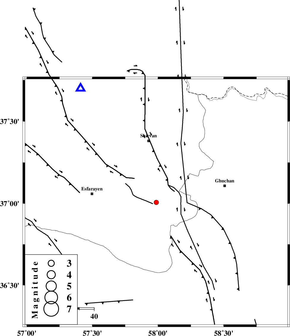
| Location | Lat:37.007 Lon: 57.987 |
| Region | Khorasan(center) Province, 42 km South of Shirvan |
Nearest Cities |
|
| 11 km North of Bam, Khorasan(north) Province | |
| 23 km South of Maviyan, Khorasan(center) Province | |
| 23 km South West of Chari, Khorasan(center) Province | |
| 25 km South of Geliyan, Khorasan(north) Province | |
| 27 km North West of Yangi qaleh, Khorasan(center) Province | |
| Depth | 15 km |
| Agency | |
Faults within 150 km: |
|
| ESFARAYEN_F (Length: 111 km) , Distance to epicenter: 17 km | |
| RIVAND_F (Length: 70 km) , Distance to epicenter: 31 km | |
| BAGHAN_GERMAB_F (Length: 79 km) , Distance to epicenter: 40 km | |
| Number of Phases | 5 |
| RMS | 0 |
| Number of Stations | 3 |
| Error in Latitude | >1.9 km |
| Error in Longitude | 6 km |
| Error in Depth | 5.8 km |
Download waveform in seisan format
to download seisan software Click here
to access information about IIEES stations Click here
Amplitude | ||||||||
| UID | Agency | Station | Component | Amplitude | Period | Arrival Time | Proccessing Time | Signal Clip |
| 101547 | IIEES | MRVT | N | 24.7 | 0.41 | 2015-09-24 21:52:54 | 2015-10-07 11:03:00 | n |
| 101548 | IIEES | MRVT | E | 27.6 | 0.29 | 2015-09-24 21:52:58 | 2015-10-07 11:03:00 | n |
| 101549 | IIEES | SHRO | N | 19.8 | 0.28 | 2015-09-24 21:52:59 | 2015-10-07 11:03:00 | n |
| 101550 | IIEES | SHRO | E | 16 | 0.43 | 2015-09-24 21:53:01 | 2015-10-07 11:03:00 | n |
Phase | ||||||||||||
| Agency | Station | Component | Phase Type | Phase Quality | First Motion | Observed Arrival Time | Time Residual | Loc. Flag | Input Weight | Distance | Azimuth | |
| IIEES | BJRD | Z | Pg | E | 2015-09-24 21:52:12 | -0.04 | y | 92.4 | 326 | |||
| IIEES | BJRD | E | Sg | E | 2015-09-24 21:52:24 | -0.01 | y | 92.4 | 326 | |||
| IIEES | MRVT | Z | Pg | E | 2015-09-24 21:52:27 | 0.07 | y | 183 | 294 | |||
| IIEES | SHRO | Z | Pn | E | 2015-09-24 21:52:30 | 0 | y | 209 | 239 | |||
| IIEES | SHRO | N | Sg | E | 2015-09-24 21:52:56 | -0.02 | y | 209 | 239 | |||