
Magnitude |
:2.8 |
| Date & Time (UTC) | 2015-09-03 22:46:05.9 |
| Date & Time (Local) | 1394/6/13 03:16:05.9 |
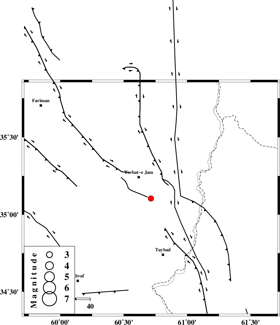
| Location | Lat:35.104 Lon: 60.714 |
| Region | Khorasan(center) Province, 18 km South of Torbat-e jam |
Nearest Cities |
|
| 18 km West of Samieabad, Khorasan(center) Province | |
| 18 km South of Torbat-e jam, Khorasan(center) Province | |
| 29 km South of Cheshmehgol, Khorasan(center) Province | |
| 32 km South East of Esmaeilabad, Khorasan(center) Province | |
| 34 km North West of Void, Khorasan(center) Province | |
| Depth | 14 km |
| Agency | |
Faults within 150 km: |
|
| TORBAT_E_JAM_F2 (Length: 57 km) , Distance to epicenter: 32 km | |
| DORUNEH_F (Length: 713 km) , Distance to epicenter: 45 km | |
| TORBAT_E_JAM_F1 (Length: 71 km) , Distance to epicenter: 71 km | |
| Number of Phases | 8 |
| RMS | 0.3 |
| Number of Stations | 6 |
| Error in Latitude | >4.1 km |
| Error in Longitude | 5.8 km |
| Error in Depth | 9.7 km |
Download waveform in seisan format
to download seisan software Click here
to access information about IIEES stations Click here
Amplitude | ||||||||
| UID | Agency | Station | Component | Amplitude | Period | Arrival Time | Proccessing Time | Signal Clip |
| 100680 | IIEES | SHRO | E | 18.7 | 0.66 | 2015-09-03 22:47:56 | 2015-09-05 06:52:00 | n |
| 100681 | IIEES | SHRO | N | 11.1 | 0.4 | 2015-09-03 22:47:56 | 2015-09-05 06:52:00 | n |
Phase | ||||||||||||
| Agency | Station | Component | Phase Type | Phase Quality | First Motion | Observed Arrival Time | Time Residual | Loc. Flag | Input Weight | Distance | Azimuth | |
| IIEES | SHRT | Z | Pg | E | 2015-09-03 22:46:33 | -0.4 | y | 166 | 194 | |||
| IIEES | SHRT | E | Sg | E | 2015-09-03 22:46:53 | 0.05 | y | 166 | 194 | |||
| IIEES | TABS | Z | Pn | E | 2015-09-03 22:46:59 | 0.14 | y | 368 | 245 | |||
| IIEES | TABS | N | Sg | E | 2015-09-03 22:47:48 | 0.02 | y | 368 | 245 | |||
| IIEES | BSRN | Z | Pn | E | 2015-09-03 22:47:01 | 0.55 | y | 378 | 203 | |||
| IIEES | BJRD | Z | Pn | E | 2015-09-03 22:47:04 | -0.15 | y | 413 | 315 | |||
| IIEES | SHRO | Z | Pn | E | 2015-09-03 22:47:07 | -0.23 | y | 438 | 285 | |||
| IIEES | MRVT | Z | Pn | E | 2015-09-03 22:47:16 | 0.11 | y | 503 | 306 | |||