
Magnitude |
:4.3 |
| Date & Time (UTC) | 2014-04-07 00:12:22.6 |
| Date & Time (Local) | 1393/1/18 04:42:22.6 |
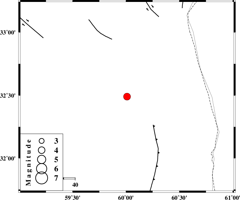
| Location | Lat:32.49 Lon: 60.01 |
| Region | Khorasan(south) Province, 26 km South-East of Sarbisheh |
Nearest Cities |
|
| 21 km East of Salmabad, Khorasan(south) Province | |
| 25 km South East of Sarbisheh, Khorasan(south) Province | |
| 40 km South East of Darmian, Khorasan(south) Province | |
| 41 km South West of Tabas masina, Khorasan(south) Province | |
| 50 km East of Kalateh soleyman, Khorasan(south) Province | |
| Depth | 14 km |
| Agency | |
Faults within 150 km: |
|
| E_NEH_F (Length: 148 km) , Distance to epicenter: 34 km | |
| NOZAD_F (Length: 27 km) , Distance to epicenter: 52 km | |
| ABRIZ_F (Length: 114 km) , Distance to epicenter: 76 km | |
| Number of Phases | 6 |
| RMS | 0.1 |
| Number of Stations | 4 |
| Error in Latitude | >2 km |
| Error in Longitude | 1.5 km |
| Error in Depth | 4.9 km |
Download waveform in seisan format
to download seisan software Click here
to access information about IIEES stations Click here
Amplitude | ||||||||
| UID | Agency | Station | Component | Amplitude | Period | Arrival Time | Proccessing Time | Signal Clip |
| 92172 | IIEES | SHRT | E | 5488.1 | 0.44 | 2014-04-07 00:13:07 | 2014-04-07 03:01:00 | n |
Phase | ||||||||||||
| Agency | Station | Component | Phase Type | Phase Quality | First Motion | Observed Arrival Time | Time Residual | Loc. Flag | Input Weight | Distance | Azimuth | |
| IIEES | SHRT | Z | Pg | E | 2014-04-07 00:12:44 | 0.06 | y | 131 | 11 | |||
| IIEES | SHRT | E | Sg | E | 2014-04-07 00:13:00 | -0.04 | y | 131 | 11 | |||
| IIEES | TABS | Z | Pn | E | 2014-04-07 00:13:07 | 0.03 | y | 299 | 296 | |||
| IIEES | TABS | E | Sg | E | 2014-04-07 00:13:46 | -0.04 | y | 299 | 296 | |||
| IIEES | ZHSF | Z | Pn | E | 2014-04-07 00:13:10 | -0.06 | y | 327 | 167 | |||
| IIEES | YZKH | Z | Pn | E | 2014-04-07 00:13:33 | 0.07 | y | 510 | 270 | |||