
Magnitude |
:5.1 |
| Date & Time (UTC) | 2012-09-02 00:50:00.4 |
| Date & Time (Local) | 1391/6/12 05:20:00.4 |
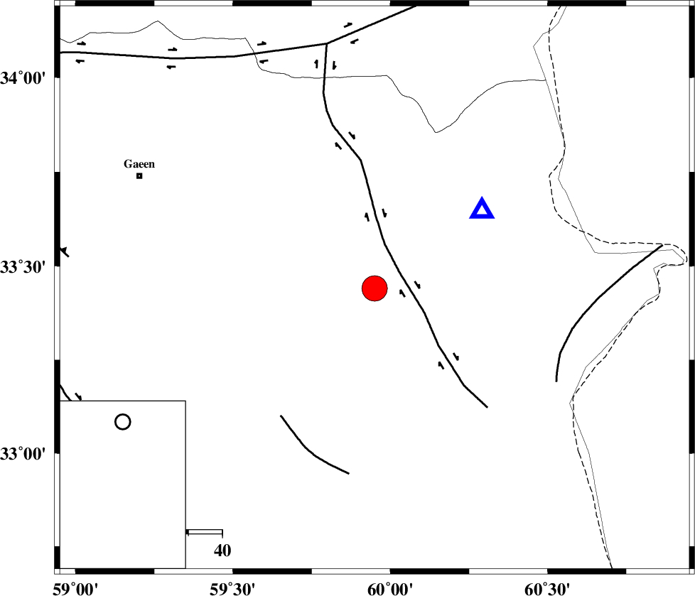
| Location | Lat:33.44 Lon: 59.95 |
| Region | Khorasan(south) Province, 92 km North-East of Sarbisheh |
Nearest Cities |
|
| 15 km North East of Zahan, Khorasan(south) Province | |
| 17 km South of Hajiabad, Khorasan(south) Province | |
| 28 km South of Abiz, Khorasan(south) Province | |
| 30 km South West of Shahdokht, Khorasan(south) Province | |
| 38 km North East of Derakhsh, Khorasan(south) Province | |
| Depth | 18 km |
| Agency | |
Faults within 150 km: |
|
| ABRIZ_F (Length: 114 km) , Distance to epicenter: 9 km | |
| NOZAD_F (Length: 27 km) , Distance to epicenter: 47 km | |
| PATARGAN_F (Length: 52 km) , Distance to epicenter: 58 km | |
| Number of Phases | 7 |
| RMS | 0.2 |
| Number of Stations | 6 |
| Error in Latitude | >3.7 km |
| Error in Longitude | 3 km |
| Error in Depth | 5.3 km |
Download waveform in seisan format
to download seisan software Click here
to access information about IIEES stations Click here
Amplitude | ||||||||
| UID | Agency | Station | Component | Amplitude | Period | Arrival Time | Proccessing Time | Signal Clip |
| 85905 | IIEES | SHRT | N | 158000 | 0.24 | 2012-09-02 00:50:13 | 2012-09-02 02:46:00 | n |
| 85906 | IIEES | SHRT | E | 268000 | 0.36 | 2012-09-02 00:50:13 | 2012-09-02 02:46:00 | n |
Phase | ||||||||||||
| Agency | Station | Component | Phase Type | Phase Quality | First Motion | Observed Arrival Time | Time Residual | Loc. Flag | Input Weight | Distance | Azimuth | |
| IIEES | SHRT | Z | Pg | E | 2012-09-02 00:50:07 | 0 | y | 38.7 | 54 | |||
| IIEES | TABS | Z | Pn | E | 2012-09-02 00:50:40 | 0.18 | y | 264 | 276 | |||
| IIEES | SHRO | Z | Pn | E | 2012-09-02 00:51:04 | -0.28 | y | 460 | 309 | |||
| IIEES | SHRO | E | Sg | E | 2012-09-02 00:52:08 | -0.01 | y | 460 | 309 | |||
| IIEES | MRVT | Z | Pn | E | 2012-09-02 00:51:20 | 0.18 | y | 585 | 324 | |||
| IIEES | NASN | Z | Pn | E | 2012-09-02 00:51:31 | -0.11 | y | 671 | 266 | |||
| IIEES | BNDS | Z | Pn | E | 2012-09-02 00:51:42 | -0.07 | y | 762 | 209 | |||