
Magnitude |
:3.2 |
| Date & Time (UTC) | 2011-01-05 15:52:09.8 |
| Date & Time (Local) | 1389/10/15 19:22:09.8 |
| Location | Lat:30.21 Lon: 51.99 |
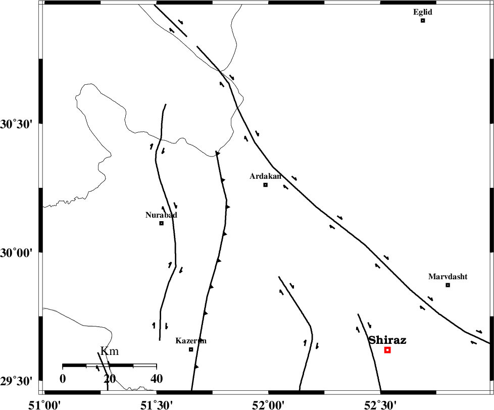
| Region | Fars Province, 6 km Ardakan |
Nearest Cities |
|
| 3 km of Bahrghan, Fars Province | |
| 6 km of Ardakan, Fars Province | |
| 28 km South East of Kamhar, Fars Province | |
| 42 km West of Dorudzan, Fars Province | |
| 43 km North West of Banesh, Fars Province | |
| Depth | 14 km |
| Agency | |
Faults within 150 km: |
|
| HZF3 (Length: 197 km) , Distance to epicenter: 7 km | |
| KAREBASS_F (Length: 98 km) , Distance to epicenter: 42 km | |
| KAZERUN_F (Length: 96 km) , Distance to epicenter: 42 km | |
| Number of Phases | 5 |
| RMS | 0.1 |
| Number of Stations | 4 |
| Error in Latitude | >2.1 km |
| Error in Longitude | 3.9 km |
| Error in Depth | 7 km |
Download waveform in seisan format
to download seisan software Click here
to access information about IIEES stations Click here
Amplitude | ||||||||
| UID | Agency | Station | Component | Amplitude | Period | Arrival Time | Proccessing Time | Signal Clip |
| 76880 | IIEES | AHRM | N | 355.7 | 0.48 | 2011-01-05 15:52:58 | 2011-01-05 04:05:00 | n |
| 76881 | IIEES | AHRM | E | 271.9 | 0.44 | 2011-01-05 15:53:02 | 2011-01-05 04:05:00 | n |
| 76882 | IIEES | SHGR | N | 55.5 | 0.64 | 2011-01-05 15:53:55 | 2011-01-05 04:05:00 | n |
| 76883 | IIEES | SHGR | E | 52.6 | 0.72 | 2011-01-05 15:53:59 | 2011-01-05 04:05:00 | n |
Phase | ||||||||||||
| Agency | Station | Component | Phase Type | Phase Quality | First Motion | Observed Arrival Time | Time Residual | Loc. Flag | Input Weight | Distance | Azimuth | |
| IIEES | AHRM | Z | Pg | E | 2011-01-05 15:52:36 | -0.1 | y | 163 | 204 | |||
| IIEES | AHRM | N | Sg | E | 2011-01-05 15:52:56 | 0 | y | 163 | 204 | |||
| IIEES | GHIR | Z | Pn | E | 2011-01-05 15:52:46 | 0.1 | y | 234 | 155 | |||
| IIEES | NASN | Z | Pn | E | 2011-01-05 15:52:54 | -0.1 | y | 298 | 15 | |||
| IIEES | SHGR | Z | P | E | 2011-01-05 15:53:03 | 0.1 | y | 370 | 306 | |||