
Magnitude |
:3.3 |
| Date & Time (UTC) | 2011-01-03 06:51:37.2 |
| Date & Time (Local) | 1389/10/13 10:21:37.2 |
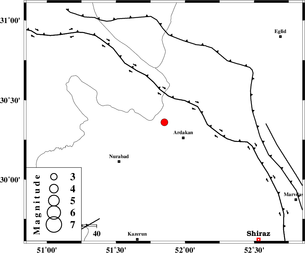
| Location | Lat:30.36 Lon: 51.85 |
| Region | Fars Province, 17 km West of Ardakan |
Nearest Cities |
|
| 10 km of Kamhar, Fars Province | |
| 17 km North West of Ardakan, Fars Province | |
| 22 km North West of Bahrghan, Fars Province | |
| 35 km North East of Masiri, Fars Province | |
| 37 km South East of Tal-e khosro, Kohkiluieh va boyerahmad Province | |
| Depth | 17 km |
| Agency | |
Faults within 150 km: |
|
| HZF3 (Length: 197 km) , Distance to epicenter: 9 km | |
| KAZERUN_F (Length: 96 km) , Distance to epicenter: 31 km | |
| DENA_F (Length: 137 km) , Distance to epicenter: 49 km | |
| Number of Phases | 5 |
| RMS | 0 |
| Number of Stations | 3 |
| Error in Latitude | >2 km |
| Error in Longitude | 2.7 km |
| Error in Depth | 5.6 km |
Download waveform in seisan format
to download seisan software Click here
to access information about IIEES stations Click here
Amplitude | ||||||||
| UID | Agency | Station | Component | Amplitude | Period | Arrival Time | Proccessing Time | Signal Clip |
| 76797 | IIEES | AHRM | E | 271.7 | 0.41 | 2011-01-03 06:52:29 | 2011-01-03 07:16:00 | n |
| 76798 | IIEES | AHRM | N | 611 | 0.53 | 2011-01-03 06:52:29 | 2011-01-03 07:16:00 | n |
| 76799 | IIEES | GHIR | N | 165.9 | 0.44 | 2011-01-03 06:53:04 | 2011-01-03 07:16:00 | n |
| 76800 | IIEES | GHIR | E | 123.4 | 0.6 | 2011-01-03 06:53:12 | 2011-01-03 07:16:00 | n |
Phase | ||||||||||||
| Agency | Station | Component | Phase Type | Phase Quality | First Motion | Observed Arrival Time | Time Residual | Loc. Flag | Input Weight | Distance | Azimuth | |
| IIEES | AHRM | Z | Pg | E | 2011-01-03 06:52:05 | 0.1 | y | 174 | 198 | |||
| IIEES | AHRM | N | Sg | E | 2011-01-03 06:52:26 | -0.1 | y | 174 | 198 | |||
| IIEES | GHIR | Z | Pn | E | 2011-01-03 06:52:16 | 0 | y | 255 | 154 | |||
| IIEES | GHIR | N | Sg | E | 2011-01-03 06:52:49 | 0 | y | 255 | 154 | |||
| IIEES | NASN | Z | Pn | E | 2011-01-03 06:52:20 | 0 | y | 285 | 18 | |||