
Magnitude |
:3.1 |
| Date & Time (UTC) | 2010-11-27 18:47:15.2 |
| Date & Time (Local) | 1389/9/6 22:17:15.2 |
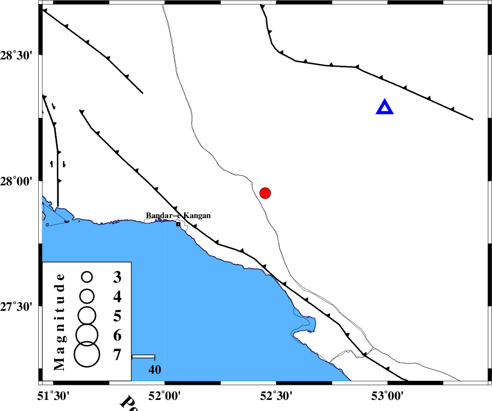
| Location | Lat:27.95 Lon: 52.45 |
| Region | Fars Province, 18 km North-East of Jam |
Nearest Cities |
|
| 19 km North East of Jam, Bushehr Province | |
| 27 km South East of Dolatabad, Fars Province | |
| 28 km West of Garmesht, Fars Province | |
| 33 km North West of Asir, Fars Province | |
| 33 km North East of Bandar-e taheri, Bushehr Province | |
| Depth | 15 km |
| Agency | |
Faults within 150 km: |
|
| MFF3 (Length: 292 km) , Distance to epicenter: 28 km | |
| QIR_F (Length: 130 km) , Distance to epicenter: 60 km | |
| MFF5 (Length: 74 km) , Distance to epicenter: 70 km | |
| Number of Phases | 4 |
| RMS | 0 |
| Number of Stations | 3 |
| Error in Latitude | >8.2 km |
| Error in Longitude | 1.8 km |
| Error in Depth | 6.6 km |
Download waveform in seisan format
to download seisan software Click here
to access information about IIEES stations Click here
Amplitude | ||||||||
| UID | Agency | Station | Component | Amplitude | Period | Arrival Time | Proccessing Time | Signal Clip |
| 74650 | IIEES | GHIR | E | 1479.5 | 0.31 | 2010-11-27 18:47:39 | 2010-11-28 03:41:00 | n |
| 74651 | IIEES | GHIR | N | 1890.2 | 0.42 | 2010-11-27 18:47:39 | 2010-11-28 03:41:00 | n |
| 74652 | IIEES | AHRM | E | 327.9 | 0.94 | 2010-11-27 18:48:11 | 2010-11-28 03:41:00 | n |
| 74653 | IIEES | KRBR | E | 12.3 | 0.47 | 2010-11-27 18:49:43 | 2010-11-28 03:41:00 | n |
| 74654 | IIEES | KRBR | N | 16.6 | 0.47 | 2010-11-27 18:49:43 | 2010-11-28 03:41:00 | n |
Phase | ||||||||||||
| Agency | Station | Component | Phase Type | Phase Quality | First Motion | Observed Arrival Time | Time Residual | Loc. Flag | Input Weight | Distance | Azimuth | |
| IIEES | GHIR | Z | Pg | E | 2010-11-27 18:47:26 | 0 | y | 64.7 | 54 | |||
| IIEES | GHIR | N | Sg | E | 2010-11-27 18:47:35 | 0 | y | 64.7 | 54 | |||
| IIEES | AHRM | Z | Pg | E | 2010-11-27 18:47:40 | 0 | y | 152 | 312 | |||
| IIEES | KRBR | Z | Pn | E | 2010-11-27 18:48:22 | 0 | y | 477 | 61 | |||