
Magnitude |
:2.7 |
| Date & Time (UTC) | 2010-11-12 18:32:07.4 |
| Date & Time (Local) | 1389/8/21 22:02:07.4 |
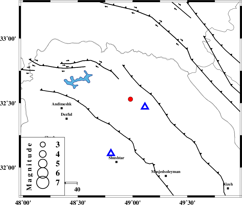
| Location | Lat:32.53 Lon: 48.98 |
| Region | Khoozestan Province, 20 km North-West of Lali |
Nearest Cities |
|
| 14 km North East of Sardasht, Khoozestan Province | |
| 20 km North West of Lali, Khoozestan Province | |
| 32 km North West of Jaefarabad, Khoozestan Province | |
| 33 km North East of Mahur berenji, Khoozestan Province | |
| 34 km South East of Shuy, Khoozestan Province | |
| Depth | 34 km |
| Agency | |
Faults within 150 km: |
|
| MFF2 (Length: 205 km) , Distance to epicenter: 14 km | |
| BALARUD_F_Z2 (Length: 58 km) , Distance to epicenter: 20 km | |
| DEZFUL_EMBAYMENT (Length: 228 km) , Distance to epicenter: 28 km | |
| Number of Phases | 5 |
| RMS | 0.2 |
| Number of Stations | 3 |
| Error in Latitude | >2.5 km |
| Error in Longitude | 3.7 km |
| Error in Depth | 4.5 km |
Download waveform in seisan format
to download seisan software Click here
to access information about IIEES stations Click here
Amplitude | ||||||||
| UID | Agency | Station | Component | Amplitude | Period | Arrival Time | Proccessing Time | Signal Clip |
| 73370 | IIEES | SHGR | N | 390.3 | 0.64 | 2010-11-12 18:32:33 | 2010-11-12 06:45:00 | n |
| 73371 | IIEES | SHGR | E | 410.6 | 0.4 | 2010-11-12 18:32:35 | 2010-11-12 06:45:00 | n |
| 73372 | IIEES | KHMZ | N | 134 | 0.44 | 2010-11-12 18:32:58 | 2010-11-12 06:45:00 | n |
| 73373 | IIEES | KHMZ | E | 125.8 | 0.52 | 2010-11-12 18:32:59 | 2010-11-12 06:45:00 | n |
Phase | ||||||||||||
| Agency | Station | Component | Phase Type | Phase Quality | First Motion | Observed Arrival Time | Time Residual | Loc. Flag | Input Weight | Distance | Azimuth | |
| IIEES | SHGR | Z | Pg | E | 2010-11-12 18:32:17 | 0 | y | 50.2 | 200 | |||
| IIEES | KHMZ | Z | Pn | E | 2010-11-12 18:32:33 | -0.2 | y | 162 | 34 | |||
| IIEES | KHMZ | E | Sg | E | 2010-11-12 18:32:53 | 0.1 | y | 162 | 34 | |||
| IIEES | SNGE | Z | Pn | E | 2010-11-12 18:32:53 | 0.3 | y | 322 | 332 | |||
| IIEES | SNGE | E | Sg | E | 2010-11-12 18:33:35 | -0.1 | y | 322 | 332 | |||