
Magnitude |
:3.4 |
| Date & Time (UTC) | 2010-10-28 11:13:34.1 |
| Date & Time (Local) | 1389/8/6 14:43:34.1 |
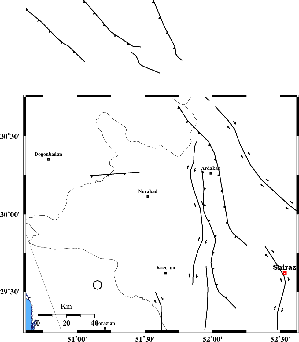
| Location | Lat:30 Lon: 51.62 |
| Region | Fars Province, 15 km South of Nurabad |
Nearest Cities |
|
| 13 km of Gachgaran, Fars Province | |
| 16 km South of Nurabad, Fars Province | |
| 22 km North of Seyyed hasan, Fars Province | |
| 23 km South East of Ahangari, Fars Province | |
| 24 km North of Nodan, Fars Province | |
| Depth | 14 km |
| Agency | |
Faults within 150 km: |
|
| KAZERUN_F (Length: 96 km) , Distance to epicenter: 5 km | |
| MISHAN_F (Length: 76 km) , Distance to epicenter: 38 km | |
| KAREBASS_F (Length: 98 km) , Distance to epicenter: 46 km | |
| Number of Phases | 5 |
| RMS | 0.1 |
| Number of Stations | 4 |
| Error in Latitude | >6.8 km |
| Error in Longitude | 6.3 km |
| Error in Depth | 20.8 km |
Download waveform in seisan format
to download seisan software Click here
to access information about IIEES stations Click here
Amplitude | ||||||||
| UID | Agency | Station | Component | Amplitude | Period | Arrival Time | Proccessing Time | Signal Clip |
| 72510 | IIEES | AHRM | N | 1644 | 0.7 | 2010-10-28 11:14:17 | 2010-10-28 11:31:00 | n |
| 72511 | IIEES | AHRM | E | 1079.6 | 0.9 | 2010-10-28 11:14:19 | 2010-10-28 11:31:00 | n |
| 72512 | IIEES | GHIR | N | 187.1 | 0.61 | 2010-10-28 11:14:56 | 2010-10-28 11:31:00 | n |
| 72513 | IIEES | GHIR | E | 159.5 | 0.51 | 2010-10-28 11:15:01 | 2010-10-28 11:31:00 | n |
Phase | ||||||||||||
| Agency | Station | Component | Phase Type | Phase Quality | First Motion | Observed Arrival Time | Time Residual | Loc. Flag | Input Weight | Distance | Azimuth | |
| IIEES | AHRM | Z | Pg | E | 2010-10-28 11:13:55 | -0.2 | y | 130 | 194 | |||
| IIEES | AHRM | E | Sg | E | 2010-10-28 11:14:11 | 0.1 | y | 130 | 194 | |||
| IIEES | GHIR | Z | Pg | E | 2010-10-28 11:14:12 | 0 | y | 232 | 145 | |||
| IIEES | NASN | Z | Pn | E | 2010-10-28 11:14:23 | 0.1 | y | 330 | 20 | |||
| IIEES | ASAO | Z | Pn | E | 2010-10-28 11:14:47 | -0.1 | y | 526 | 344 | |||