
Magnitude |
:3.3 |
| Date & Time (UTC) | 2010-09-20 02:55:00.5 |
| Date & Time (Local) | 1389/6/29 07:25:00.5 |
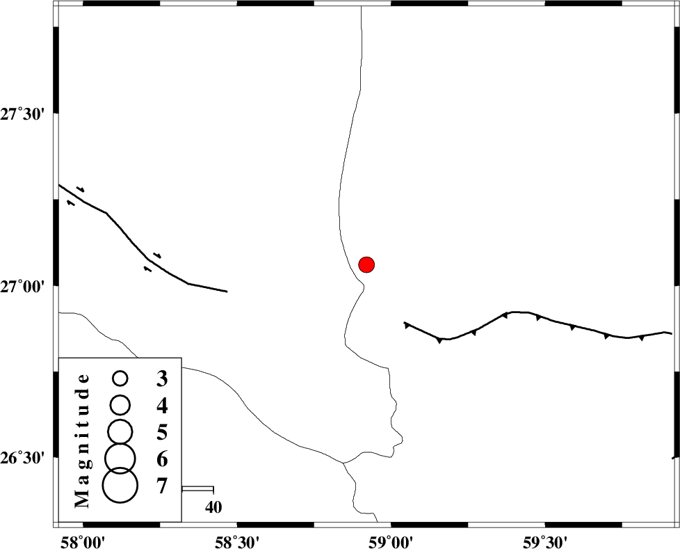
| Location | Lat:27.06 Lon: 58.92 |
| Region | Sistan va Baloochestan Province, 146 km South-East of Manujan |
Nearest Cities |
|
| 28 km North East of Ramashk, Kerman Province | |
| 67 km South West of Kalemursi, Sistan va Baloochestan Province | |
| 76 km North West of Tutan, Sistan va Baloochestan Province | |
| 89 km North West of Fonuj, Sistan va Baloochestan Province | |
| 92 km North West of Maskutan, Sistan va Baloochestan Province | |
| Depth | 15 km |
| Agency | |
Faults within 150 km: |
|
| S_JAZMURIAN_F (Length: 91 km) , Distance to epicenter: 22 km | |
| JIROFT_F (Length: 144 km) , Distance to epicenter: 46 km | |
| LASHAR_F (Length: 68 km) , Distance to epicenter: 117 km | |
| Number of Phases | 5 |
| RMS | 0.4 |
| Number of Stations | 5 |
| Error in Latitude | >5.9 km |
| Error in Longitude | 3.2 km |
| Error in Depth | 0 km |
Download waveform in seisan format
to download seisan software Click here
to access information about IIEES stations Click here
Amplitude | ||||||||
| UID | Agency | Station | Component | Amplitude | Period | Arrival Time | Proccessing Time | Signal Clip |
| 70710 | IIEES | BNDS | N | 113.8 | 0.24 | 2010-09-20 02:56:12 | 2010-09-20 03:08:00 | n |
| 70711 | IIEES | BNDS | E | 112.3 | 0.15 | 2010-09-20 02:56:13 | 2010-09-20 03:08:00 | n |
| 70712 | IIEES | KRBR | E | 79.4 | 0.18 | 2010-09-20 02:56:38 | 2010-09-20 03:08:00 | n |
| 70713 | IIEES | KRBR | N | 61.3 | 0.29 | 2010-09-20 02:56:40 | 2010-09-20 03:08:00 | n |
Phase | ||||||||||||
| Agency | Station | Component | Phase Type | Phase Quality | First Motion | Observed Arrival Time | Time Residual | Loc. Flag | Input Weight | Distance | Azimuth | |
| IIEES | CHBR | Z | Pn | E | 2010-09-20 02:55:36 | 0 | y | 226 | 136 | |||
| IIEES | BNDS | Z | Pn | E | 2010-09-20 02:55:42 | 0.4 | y | 274 | 278 | |||
| IIEES | ZHSF | Z | Pn | E | 2010-09-20 02:55:50 | 0.1 | y | 336 | 32 | |||
| IIEES | KRBR | Z | Pn | E | 2010-09-20 02:55:56 | -0.1 | y | 386 | 327 | |||
| IIEES | GHIR | Z | Pn | E | 2010-09-20 02:56:22 | -0.7 | y | 600 | 284 | |||