
Magnitude |
:3.4 |
| Date & Time (UTC) | 2010-07-25 20:52:08.6 |
| Date & Time (Local) | 1389/5/4 01:22:08.6 |
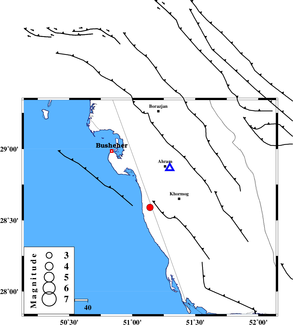
| Location | Lat:28.59 Lon: 51.14 |
| Region | Bushehr Province, 24 km West of Khormog |
Nearest Cities |
|
| 9 km of Derazi, Bushehr Province | |
| 20 km South of Delvar, Bushehr Province | |
| 22 km North West of Buheyri, Bushehr Province | |
| 24 km West of Khormog, Bushehr Province | |
| 34 km South West of Ahram, Bushehr Province | |
| Depth | 20 km |
| Agency | |
Faults within 150 km: |
|
| ZFF2 (Length: 84 km) , Distance to epicenter: 3 km | |
| BORAZJAN_F (Length: 168 km) , Distance to epicenter: 21 km | |
| MFF5 (Length: 74 km) , Distance to epicenter: 28 km | |
| Number of Phases | 5 |
| RMS | 0 |
| Number of Stations | 4 |
| Error in Latitude | >5.5 km |
| Error in Longitude | 5.3 km |
| Error in Depth | 3.5 km |
Download waveform in seisan format
to download seisan software Click here
to access information about IIEES stations Click here
Amplitude | ||||||||
| UID | Agency | Station | Component | Amplitude | Period | Arrival Time | Proccessing Time | Signal Clip |
| 66710 | IIEES | GHIR | E | 508 | 0.4 | 2010-07-25 20:53:02 | 2010-07-25 09:13:00 | n |
| 66711 | IIEES | GHIR | N | 313.9 | 0.6 | 2010-07-25 20:53:10 | 2010-07-25 09:13:00 | n |
| 66712 | IIEES | KRBR | N | 25 | 0.44 | 2010-07-25 20:54:25 | 2010-07-25 09:13:00 | n |
| 66713 | IIEES | KRBR | E | 24.1 | 0.52 | 2010-07-25 20:54:25 | 2010-07-25 09:13:00 | n |
Phase | ||||||||||||
| Agency | Station | Component | Phase Type | Phase Quality | First Motion | Observed Arrival Time | Time Residual | Loc. Flag | Input Weight | Distance | Azimuth | |
| IIEES | AHRM | Z | Pg | E | 2010-07-25 20:52:15 | 0 | y | 34.6 | 27 | |||
| IIEES | GHIR | Z | Pg | E | 2010-07-25 20:52:38 | 0 | y | 184 | 100 | |||
| IIEES | GHIR | E | Sg | E | 2010-07-25 20:53:00 | 0 | y | 184 | 100 | |||
| IIEES | KRBR | Z | Pn | E | 2010-07-25 20:53:26 | 0 | y | 568 | 73 | |||
| IIEES | ASAO | Z | P | E | 2010-07-25 20:53:39 | 0 | y | 669 | 351 | |||