
Magnitude |
:3.1 |
| Date & Time (UTC) | 2010-07-03 08:50:40.3 |
| Date & Time (Local) | 1389/4/12 13:20:40.3 |
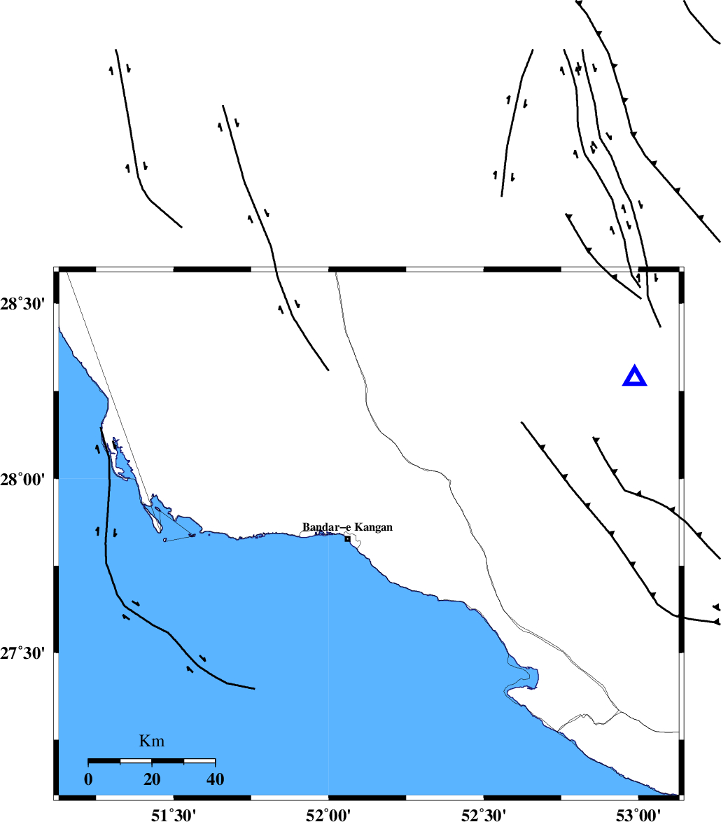
| Location | Lat:27.84 Lon: 52.13 |
| Region | Bushehr Province, 7 km Bandar-e kangan |
Nearest Cities |
|
| 7 km North of Bandar-e kangan, Bushehr Province | |
| 18 km North West of Jam, Bushehr Province | |
| 24 km South of Riz, Bushehr Province | |
| 28 km North West of Bandar-e taheri, Bushehr Province | |
| 38 km South West of Dolatabad, Fars Province | |
| Depth | 14 km |
| Agency | |
Faults within 150 km: |
|
| MFF3 (Length: 292 km) , Distance to epicenter: 3 km | |
| BORAZJAN_F (Length: 168 km) , Distance to epicenter: 60 km | |
| MFF5 (Length: 74 km) , Distance to epicenter: 61 km | |
| Number of Phases | 4 |
| RMS | 0 |
| Number of Stations | 3 |
| Error in Latitude | >7 km |
| Error in Longitude | 3.7 km |
| Error in Depth | 5.4 km |
Download waveform in seisan format
to download seisan software Click here
to access information about IIEES stations Click here
Amplitude | ||||||||
| UID | Agency | Station | Component | Amplitude | Period | Arrival Time | Proccessing Time | Signal Clip |
| 65286 | IIEES | GHIR | N | 607.4 | 0.5 | 2010-07-03 08:51:16 | 2010-07-04 02:01:00 | n |
| 65287 | IIEES | KRBR | N | 16.3 | 0.38 | 2010-07-03 08:52:50 | 2010-07-04 02:01:00 | n |
| 65288 | IIEES | KRBR | E | 16.5 | 0.38 | 2010-07-03 08:52:51 | 2010-07-04 02:01:00 | n |
Phase | ||||||||||||
| Agency | Station | Component | Phase Type | Phase Quality | First Motion | Observed Arrival Time | Time Residual | Loc. Flag | Input Weight | Distance | Azimuth | |
| IIEES | GHIR | Z | Pg | E | 2010-07-03 08:50:56 | 0 | y | 97.5 | 59 | |||
| IIEES | AHRM | Z | Pg | E | 2010-07-03 08:51:03 | 0 | y | 140 | 324 | |||
| IIEES | AHRM | N | Sg | E | 2010-07-03 08:51:20 | 0 | y | 140 | 324 | |||
| IIEES | KRBR | Z | Pn | E | 2010-07-03 08:51:51 | 0 | y | 510 | 61 | |||