
Magnitude |
:2.6 |
| Date & Time (UTC) | 2010-04-21 00:34:46.7 |
| Date & Time (Local) | 1389/2/1 05:04:46.7 |
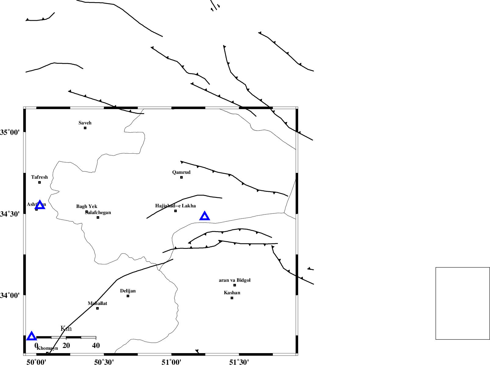
| Location | Lat:34.39 Lon: 50.92 |
| Region | Qom Province, 29 km South of Qom |
Nearest Cities |
|
| 5 km North of Kahak, Qom Province | |
| 17 km South West of Hajiabad-e lakha, Qom Province | |
| 20 km North of Yahyaabad, Esfahan Province | |
| 29 km South of Qom, Qom Province | |
| 32 km North East of Vasqonqan, Markazi Province | |
| Depth | 16 km |
| Agency | |
Faults within 150 km: |
|
| INDES_F (Length: 98 km) , Distance to epicenter: 39 km | |
| KASHAN_F (Length: 44 km) , Distance to epicenter: 42 km | |
| KUSHK_E_NOSRAT_F (Length: 230 km) , Distance to epicenter: 50 km | |
| Number of Phases | 5 |
| RMS | 0.3 |
| Number of Stations | 4 |
| Error in Latitude | >12.3 km |
| Error in Longitude | 19.1 km |
| Error in Depth | 52.9 km |
Download waveform in seisan format
to download seisan software Click here
to access information about IIEES stations Click here
Amplitude | ||||||||
| UID | Agency | Station | Component | Amplitude | Period | Arrival Time | Proccessing Time | Signal Clip |
| 60770 | IIEES | GHVR | N | 632.3 | 0.26 | 2010-04-21 00:34:57 | 2010-04-21 12:43:00 | n |
| 60771 | IIEES | GHVR | E | 1021.7 | 0.32 | 2010-04-21 00:34:58 | 2010-04-21 12:43:00 | n |
| 60772 | IIEES | DAMV | E | 65.6 | 0.33 | 2010-04-21 00:35:36 | 2010-04-21 12:43:00 | n |
Phase | ||||||||||||
| Agency | Station | Component | Phase Type | Phase Quality | First Motion | Observed Arrival Time | Time Residual | Loc. Flag | Input Weight | Distance | Azimuth | |
| IIEES | GHVR | Z | Pg | E | 2010-04-21 00:34:53 | 0.6 | y | 31.1 | 72 | |||
| IIEES | GHVR | N | Sg | E | 2010-04-21 00:34:56 | -0.3 | y | 31.1 | 72 | |||
| IIEES | KHMZ | Z | Pg | E | 2010-04-21 00:35:05 | -0.1 | y | 114 | 231 | |||
| IIEES | DAMV | Z | Pg | E | 2010-04-21 00:35:14 | -0.2 | y | 167 | 35 | |||
| IIEES | CHTH | Z | Pg | E | 2010-04-21 00:35:14 | 0.1 | y | 169 | 6 | |||