
Magnitude |
:3.9 |
| Date & Time (UTC) | 2007-01-06 16:33:16.8 |
| Date & Time (Local) | 1385/10/16 20:03:16.8 |
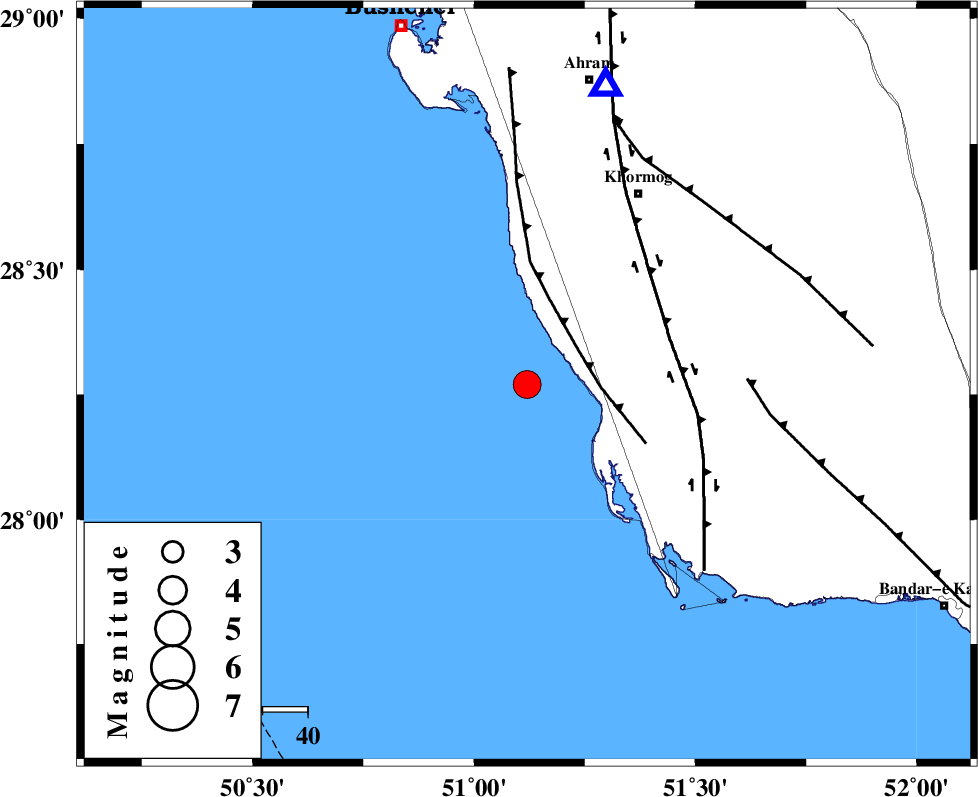
| Location | Lat:28.27 Lon: 51.12 |
| Region | Persian Gulf, 48 km South-West of Khormog |
Nearest Cities |
|
| 27 km North West of Ziyarat, Bushehr Province | |
| 39 km South West of Baduleh, Bushehr Province | |
| 39 km West of Kaki, Bushehr Province | |
| 40 km South West of Derazi, Bushehr Province | |
| 41 km North West of Abkesh, Bushehr Province | |
| Depth | 41 km |
| Agency | |
Faults within 150 km: |
|
| ZFF2 (Length: 84 km) , Distance to epicenter: 14 km | |
| BORAZJAN_F (Length: 168 km) , Distance to epicenter: 33 km | |
| MFF3 (Length: 292 km) , Distance to epicenter: 49 km | |
| Number of Phases | 7 |
| RMS | 0.4 |
| Number of Stations | 6 |
| Error in Latitude | >14.8 km |
| Error in Longitude | 13.1 km |
| Error in Depth | 13.4 km |
Download waveform in seisan format
to download seisan software Click here
to access information about IIEES stations Click here
Amplitude | ||||||||
| UID | Agency | Station | Component | Amplitude | Period | Arrival Time | Proccessing Time | Signal Clip |
| 37225 | IIEES | GHIR | E | 1132.2 | 0.48 | 2007-01-06 16:34:10 | 2007-05-09 05:26:00 | n |
| 37226 | IIEES | GHIR | N | 1275.8 | 0.56 | 2007-01-06 16:34:10 | 2007-05-09 05:26:00 | n |
Phase | ||||||||||||
| Agency | Station | Component | Phase Type | Phase Quality | First Motion | Observed Arrival Time | Time Residual | Loc. Flag | Input Weight | Distance | Azimuth | |
| IIEES | GHIR | Z | Pg | E | 2007-01-06 16:33:46 | -0.1 | y | 183 | 89 | |||
| IIEES | GHIR | N | Sg | E | 2007-01-06 16:34:08 | 0.1 | y | 183 | 89 | |||
| IIEES | BNDS | Z | Pn | E | 2007-01-06 16:34:24 | -0.3 | y | 507 | 100 | |||
| IIEES | NASN | Z | Pn | E | 2007-01-06 16:34:27 | -0.8 | y | 527 | 17 | |||
| IIEES | KRBR | Z | Pn | E | 2007-01-06 16:34:35 | 0.6 | y | 580 | 70 | |||
| IIEES | ASAO | Z | Pn | E | 2007-01-06 16:34:50 | 0.5 | y | 704 | 352 | |||
| IIEES | SNGE | Z | Pn | E | 2007-01-06 16:35:06 | 0.4 | y | 836 | 336 | |||