
Magnitude |
:3.2 |
| Date & Time (UTC) | 2006-12-07 23:15:59.0 |
| Date & Time (Local) | 1385/9/17 02:45:59.0 |
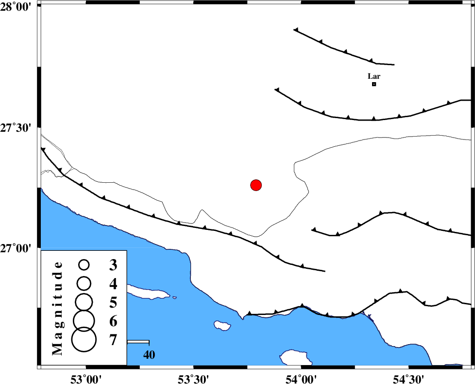
| Location | Lat:27.26 Lon: 53.79 |
| Region | 57 km West of Bastak, Hormozgan Province |
Nearest Cities |
|
| 11 km North of Ahl, Fars Province | |
| 18 km North East of Ashkenan, Fars Province | |
| 33 km South East of Beyram, Fars Province | |
| 36 km South West of Bagh, Fars Province | |
| 45 km South East of Fedagh, Fars Province | |
| Depth | 14 km |
| Agency | |
Faults within 150 km: |
|
| MFF3 (Length: 292 km) , Distance to epicenter: 25 km | |
| MFF1 (Length: 180 km) , Distance to epicenter: 33 km | |
| LAR_F (Length: 99 km) , Distance to epicenter: 42 km | |
| Number of Phases | 4 |
| RMS | 0.1 |
| Number of Stations | 3 |
| Error in Latitude | >9.8 km |
| Error in Longitude | 7.1 km |
| Error in Depth | 6.6 km |
Download waveform in seisan format
to download seisan software Click here
to access information about IIEES stations Click here
Amplitude | ||||||||
| UID | Agency | Station | Component | Amplitude | Period | Arrival Time | Proccessing Time | Signal Clip |
| 36876 | IIEES | GHIR | E | 754 | 0.37 | 2006-12-07 23:16:44 | 2007-01-07 07:24:00 | n |
| 36877 | IIEES | GHIR | N | 596.1 | 0.16 | 2006-12-07 23:16:44 | 2007-01-07 07:24:00 | n |
| 36878 | IIEES | BNDS | E | 92.8 | 1 | 2006-12-07 23:17:26 | 2007-01-07 07:24:00 | n |
| 36879 | IIEES | KRBR | N | 37.8 | 0.68 | 2006-12-07 23:17:59 | 2007-01-07 07:24:00 | n |
| 36880 | IIEES | KRBR | E | 49.8 | 0.37 | 2006-12-07 23:18:05 | 2007-01-07 07:24:00 | n |
Phase | ||||||||||||
| Agency | Station | Component | Phase Type | Phase Quality | First Motion | Observed Arrival Time | Time Residual | Loc. Flag | Input Weight | Distance | Azimuth | |
| IIEES | GHIR | Z | Pg | E | 2006-12-07 23:16:22 | 0 | y | 138 | 325 | |||
| IIEES | GHIR | N | Sg | E | 2006-12-07 23:16:38 | 0 | y | 138 | 325 | |||
| IIEES | BNDS | Z | Pg | E | 2006-12-07 23:16:37 | -0.1 | y | 237 | 86 | |||
| IIEES | KRBR | Z | Pn | E | 2006-12-07 23:16:59 | 0.1 | y | 419 | 43 | |||