
Magnitude |
:2.6 |
| Date & Time (UTC) | 2006-09-24 15:11:51.3 |
| Date & Time (Local) | 1385/7/2 18:41:51.3 |
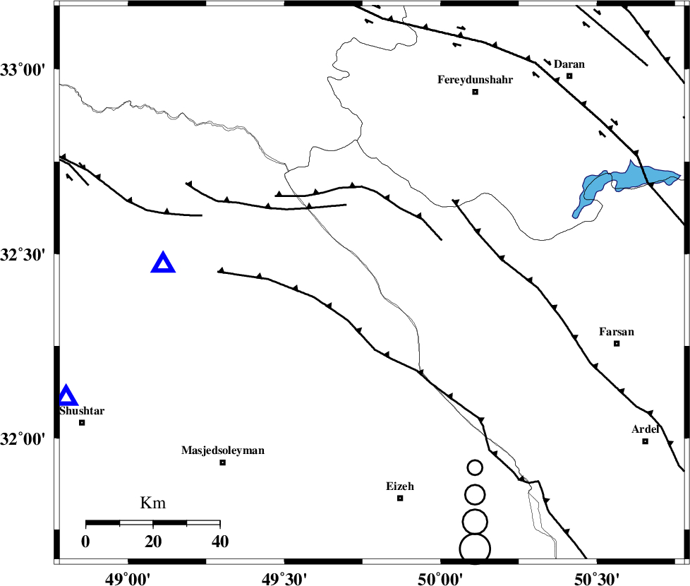
| Location | Lat:32.42 Lon: 49.78 |
| Region | 32 km West of Chelgard, Chaharmahal Bakhtiari Province |
Nearest Cities |
|
| 25 km North East of Paabshalal, Khoozestan Province | |
| 31 km South of Durak, Chaharmahal Bakhtiari Province | |
| 32 km West of Chelgard, Chaharmahal Bakhtiari Province | |
| 40 km North East of Qale-yekhvaju, Khoozestan Province | |
| 47 km North of Torshak, Khoozestan Province | |
| Depth | 14 km |
| Agency | |
Faults within 150 km: |
|
| ZARDKUH_F (Length: 139 km) , Distance to epicenter: 22 km | |
| ARDAL_F (Length: 170 km) , Distance to epicenter: 27 km | |
| MFF2 (Length: 205 km) , Distance to epicenter: 32 km | |
| Number of Phases | 4 |
| RMS | 0.1 |
| Number of Stations | 4 |
| Error in Latitude | >2.7 km |
| Error in Longitude | 2.9 km |
| Error in Depth | 4.8 km |
Download waveform in seisan format
to download seisan software Click here
to access information about IIEES stations Click here
Amplitude | ||||||||
| UID | Agency | Station | Component | Amplitude | Period | Arrival Time | Proccessing Time | Signal Clip |
| 36023 | IIEES | SHGR | N | 149.1 | 0.52 | 2006-09-24 15:12:28 | 2006-10-17 03:59:00 | n |
| 36024 | IIEES | SHGR | E | 144.3 | 0.36 | 2006-09-24 15:12:28 | 2006-10-17 03:59:00 | n |
| 36025 | IIEES | ASAO | N | 66 | 0.52 | 2006-09-24 15:12:59 | 2006-10-17 03:59:00 | n |
| 36026 | IIEES | ASAO | E | 42.3 | 0.48 | 2006-09-24 15:13:01 | 2006-10-17 03:59:00 | n |
| 36027 | IIEES | NASN | N | 17 | 0.56 | 2006-09-24 15:13:12 | 2006-10-17 03:59:00 | n |
| 36028 | IIEES | NASN | E | 21.5 | 0.64 | 2006-09-24 15:13:13 | 2006-10-17 03:59:00 | n |
Phase | ||||||||||||
| Agency | Station | Component | Phase Type | Phase Quality | First Motion | Observed Arrival Time | Time Residual | Loc. Flag | Input Weight | Distance | Azimuth | |
| IIEES | SHGR | Z | PG | E | 2006-09-24 15:12:07 | 0 | y | 98.7 | 249 | |||
| IIEES | ASAO | Z | PG | E | 2006-09-24 15:12:30 | -0.1 | y | 237 | 5 | |||
| IIEES | NASN | Z | PN | E | 2006-09-24 15:12:34 | 0 | y | 287 | 81 | |||
| IIEES | SNGE | Z | Pn | E | 2006-09-24 15:12:45 | 0.1 | y | 372 | 323 | |||