
Magnitude |
:3.5 |
| Date & Time (UTC) | 2006-09-12 16:29:32.8 |
| Date & Time (Local) | 1385/6/21 19:59:32.8 |
| Location | Lat:27.93 Lon: 57.31 |
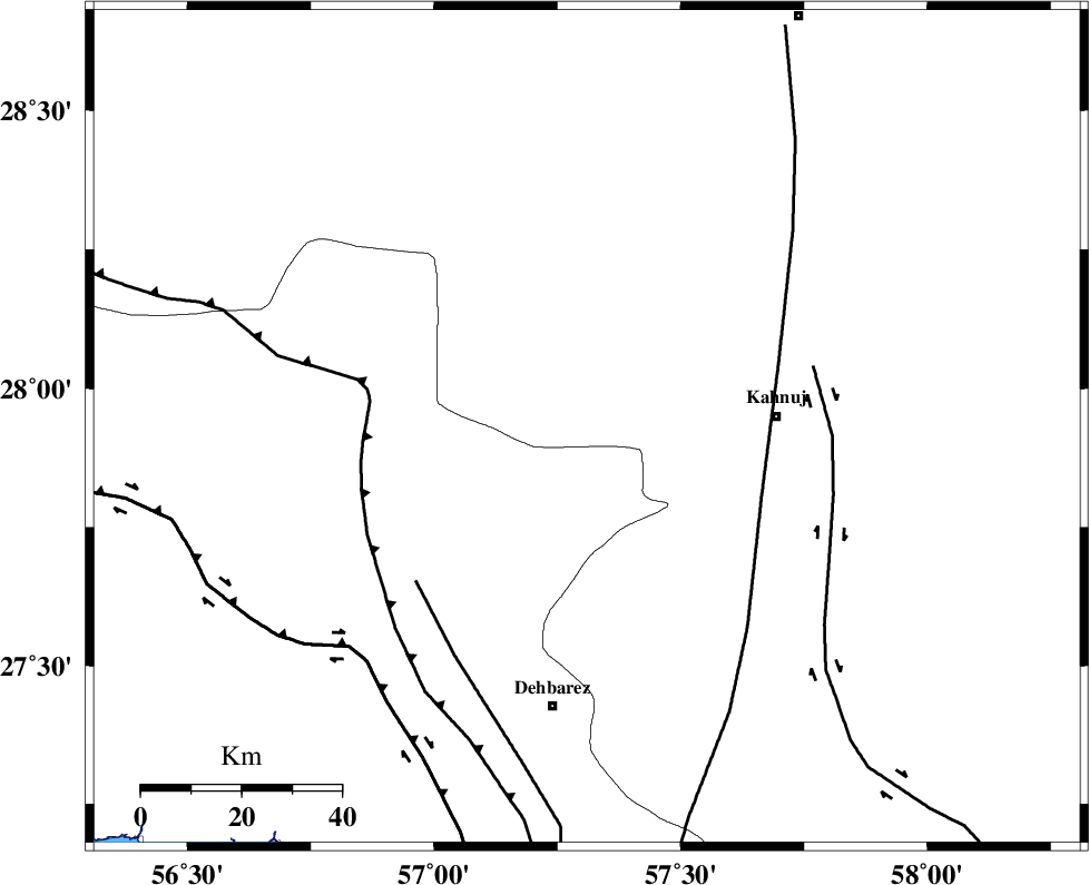
| Region | 37 km West of Kahnuj, Kerman Province |
Nearest Cities |
|
| 13 km North of Fariab, Hormozgan Province | |
| 16 km South of Faryab, Kerman Province | |
| 20 km South of Mehrueye-e paeen, Kerman Province | |
| 23 km North of Ziaratali, Hormozgan Province | |
| 29 km South of Hurpasefid, Kerman Province | |
| Depth | 46 km |
| Agency | |
Faults within 150 km: |
|
| SABZEVARAN_F (Length: 190 km) , Distance to epicenter: 38 km | |
| MAIN_ZAGROS_R_F (Length: 1106 km) , Distance to epicenter: 44 km | |
| ZENDAN_MINAB_F_Z1 (Length: 183 km) , Distance to epicenter: 46 km | |
| Number of Phases | 5 |
| RMS | 0.1 |
| Number of Stations | 3 |
| Error in Latitude | >2.4 km |
| Error in Longitude | 5.9 km |
| Error in Depth | 3.4 km |
Download waveform in seisan format
to download seisan software Click here
to access information about IIEES stations Click here
Amplitude | ||||||||
| UID | Agency | Station | Component | Amplitude | Period | Arrival Time | Proccessing Time | Signal Clip |
| 35584 | IIEES | BNDS | E | 891.4 | 0.4 | 2006-09-12 16:30:12 | 2006-10-17 03:59:00 | n |
| 35585 | IIEES | KRBR | N | 317.2 | 0.36 | 2006-09-12 16:30:40 | 2006-10-17 03:59:00 | n |
| 35586 | IIEES | KRBR | E | 238 | 0.44 | 2006-09-12 16:30:41 | 2006-10-17 03:59:00 | n |
Phase | ||||||||||||
| Agency | Station | Component | Phase Type | Phase Quality | First Motion | Observed Arrival Time | Time Residual | Loc. Flag | Input Weight | Distance | Azimuth | |
| IIEES | BNDS | Z | PG | E | 2006-09-12 16:29:54 | 0.1 | y | 127 | 243 | |||
| IIEES | BNDS | E | Sg | E | 2006-09-12 16:30:10 | 0 | y | 127 | 243 | |||
| IIEES | KRBR | Z | PG | E | 2006-09-12 16:30:10 | 0 | y | 234 | 347 | |||
| IIEES | KRBR | N | SG | E | 2006-09-12 16:30:38 | 0 | y | 234 | 347 | |||
| IIEES | GHIR | Z | PN | E | 2006-09-12 16:30:30 | -0.1 | y | 427 | 276 | |||