
Magnitude |
:3.1 |
| Date & Time (UTC) | 2026-06-16 02:33:10.1 |
| Date & Time (Local) | 1405/3/26 06:03:10.1 |
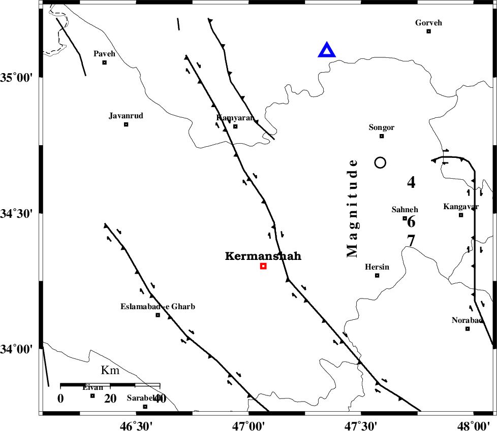
| Location | Lat:34.517 Lon: 47.085 |
| Region | Kermanshah Province, 24 km North of Kermanshah |
Nearest Cities |
|
| 8 km North of Qazanchi, Kermanshah Province | |
| 20 km South West of Kanduleh, Kermanshah Province | |
| 24 km North of Kermanshah, Kermanshah Province | |
| 24 km South of Marzbani, Kermanshah Province | |
| 28 km West of Mianrahan, Kermanshah Province | |
| Depth | 16 km |
| Agency | |
Faults within 150 km: |
|
| SARTAKHT_F (Length: 78 km) , Distance to epicenter: 33 km | |
| DINEHVAR_F (Length: 46 km) , Distance to epicenter: 33 km | |
| MORVARID_F (Length: 24 km) , Distance to epicenter: 36 km | |
| Number of Phases | 8 |
| RMS | 0.4 |
| Number of Stations | 8 |
| Error in Latitude | >6.9 km |
| Error in Longitude | 6.9 km |
| Error in Depth | 11.9 km |
Download waveform in seisan format
to download seisan software Click here
to access information about IIEES stations Click here
Amplitude | ||||||||
| UID | Agency | Station | Component | Amplitude | Period | Arrival Time | Proccessing Time | Signal Clip |
| 201862 | IIEES SC | ASAO | Z | 0.1 | 1 | 2026-06-16 02:33:52 | 2026-06-16 07:26:00 | n |
| 201863 | IIEES SC | GHVR | Z | 0.08 | 1 | 2026-06-16 02:34:05 | 2026-06-16 07:26:00 | n |
| 201864 | IIEES SC | NASN | Z | 0.01 | 1 | 2026-06-16 02:34:27 | 2026-06-16 07:26:00 | n |
| 201865 | IIEES SC | GURO | Z | 0.01 | 1 | 2026-06-16 02:34:36 | 2026-06-16 07:26:00 | n |
Phase | ||||||||||||
| Agency | Station | Component | Phase Type | Phase Quality | First Motion | Observed Arrival Time | Time Residual | Loc. Flag | Input Weight | Distance | Azimuth | |
| IIEES SC | HNVD | Z | EPg | E | 2026-06-16 02:33:28 | -0.3 | y | 0 | 110 | 102 | ||
| IIEES SC | DOB | Z | EPg | E | 2026-06-16 02:33:32 | 0.7 | y | 0 | 129 | 129 | ||
| IIEES SC | ASAO | Z | EPn | E | 2026-06-16 02:33:52 | 0.7 | y | 0 | 270 | 89 | ||
| IIEES SC | GHVR | Z | EPn | E | 2026-06-16 02:34:05 | -0.1 | y | 0 | 382 | 91 | ||
| IIEES SC | BRJ | Z | EPn | E | 2026-06-16 02:34:17 | -0.8 | y | 0 | 485 | 127 | ||
| IIEES SC | NASN | Z | EPn | E | 2026-06-16 02:34:27 | -0.6 | y | 0 | 564 | 110 | ||
| IIEES SC | GURO | Z | EPn | E | 2026-06-16 02:34:36 | 0 | y | 0 | 636 | 315 | ||
| IIEES SC | GNI | Z | EPn | E | 2026-06-16 02:34:05 | -34 | n | 4 | 658 | 342 | ||