
Magnitude |
:3.1 |
| Date & Time (UTC) | 2026-06-05 19:05:23.7 |
| Date & Time (Local) | 1405/3/15 22:35:23.7 |
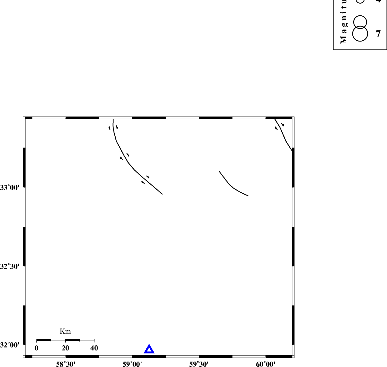
| Location | Lat:32.681 Lon: 59.198 |
| Region | Khorasan(south) Province, 25 km South of Birjand |
Nearest Cities |
|
| 9 km of Gol, Khorasan(south) Province | |
| 17 km North West of Gaz, Khorasan(south) Province | |
| 21 km North East of Mazhan, Khorasan(south) Province | |
| 25 km South of Birjand, Khorasan(south) Province | |
| 30 km North West of Mokhtaran, Khorasan(south) Province | |
| Depth | 12 km |
| Agency | |
Faults within 150 km: |
|
| MOHAMMADABAD_F (Length: 71 km) , Distance to epicenter: 31 km | |
| NOZAD_F (Length: 27 km) , Distance to epicenter: 62 km | |
| FERDOWS_F (Length: 101 km) , Distance to epicenter: 96 km | |
| Number of Phases | 9 |
| RMS | 0.1 |
| Number of Stations | 9 |
| Error in Latitude | >0.6 km |
| Error in Longitude | 0.6 km |
| Error in Depth | 1.2 km |
Download waveform in seisan format
to download seisan software Click here
to access information about IIEES stations Click here
Amplitude | ||||||||
| UID | Agency | Station | Component | Amplitude | Period | Arrival Time | Proccessing Time | Signal Clip |
| 201808 | IIEES SC | KOO | Z | 30 | 1 | 2026-06-05 19:05:30 | 2026-06-06 06:58:00 | n |
| 201809 | IIEES SC | BSRN | Z | 0.8 | 1 | 2026-06-05 19:05:37 | 2026-06-06 06:58:00 | n |
| 201810 | IIEES SC | KRVR | Z | 0.1 | 1 | 2026-06-05 19:06:02 | 2026-06-06 06:58:00 | n |
| 201811 | IIEES SC | NASN | Z | 0.02 | 1 | 2026-06-05 19:06:46 | 2026-06-06 06:58:00 | n |
Phase | ||||||||||||
| Agency | Station | Component | Phase Type | Phase Quality | First Motion | Observed Arrival Time | Time Residual | Loc. Flag | Input Weight | Distance | Azimuth | |
| IIEES SC | KOO | Z | EPg | E | 2026-06-05 19:05:30 | 0 | y | 0 | 34 | 213 | ||
| IIEES SC | BSRN | Z | EPg | E | 2026-06-05 19:05:37 | 0 | y | 0 | 80 | 185 | ||
| IIEES SC | SHRT | Z | EPg | E | 2026-06-05 19:05:48 | 0 | y | 0 | 148 | 44 | ||
| IIEES SC | TABS | Z | EPn | E | 2026-06-05 19:06:02 | 2.7 | n | 4 | 222 | 299 | ||
| IIEES SC | KRVR | Z | EPn | E | 2026-06-05 19:06:02 | -0.1 | y | 0 | 248 | 243 | ||
| IIEES SC | YZKH | Z | EPn | E | 2026-06-05 19:05:56 | -29.4 | n | 4 | 434 | 266 | ||
| IIEES SC | SHRO | Z | EPn | E | 2026-06-05 19:06:35 | 5.1 | n | 4 | 471 | 322 | ||
| IIEES SC | BJRD | Z | EPn | E | 2026-06-05 19:06:43 | -0.1 | y | 0 | 580 | 344 | ||
| IIEES SC | NASN | Z | EPn | E | 2026-06-05 19:06:46 | 0.2 | y | 0 | 599 | 271 | ||